These pages presented here and as with most pages from Desertsunrise due
to the copious heavy use of large photos, these pages are
unfortunately NOT very mobile friendly. The webmaster at Desertsunrise
is working on rectifying this issue at present.
The pages are
best viewed with browsers like
Mozilla Firefox,
Google Chrome,
Microsoft
Edge and Apple's
Safari
(Note that Apple no longer supports Safari for Windows!)
. If you are still using Internet Exploder please
be aware that on some of the pages you might see a active content popup
on the bottom of the page, YES it is OK to click yes.
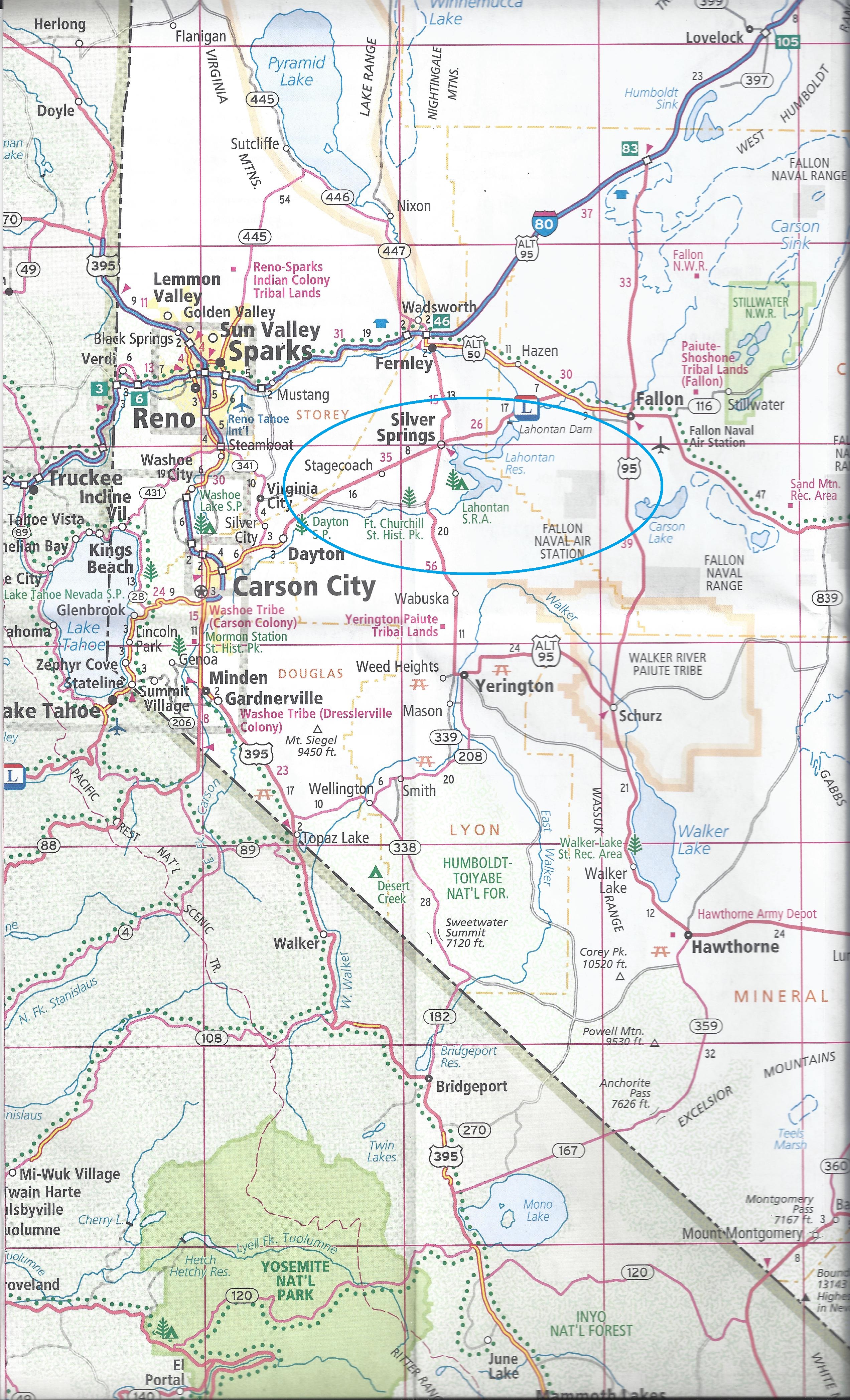
Above you will find the
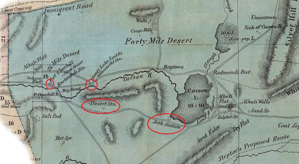
Fort Churchill and Honey lake Smith locations on a Map of the Pony
Express stations in the Nevada Segment of the DeGroot 1863 map.
(Map Courtesy the Library of Congress.)Beware that Williams Station, Carson Sink Station and Hooten
Wells Station are not shown on the above segment of the DeGroot 1863
Nevada Map. This is probably due to the Pony Express route having been
changed from the original 1860 routes. The DeGroot map was created after
the Pony Express had ended it's service.
The Nevada State Parks
Brochure has this input for directions to the park:
Fort Churchill is located along the Carson River, eight miles
south of Silver Springs on U.S. 95A. The park is 40 miles east
of Carson City and 36 miles west of Fallon. Visitors are advised
to enter the park from U.S. 95A, on a short, paved access road.
While Fort Churchill Road along the Carson River from U.S. 50 is
scenic, it is 16 miles and unpaved.
The Churchill Road route is by far the most scenic drive but the
road can be rough at times and if you are not accustomed to road dust,
bumps, rocks and biting horse flies then taking US50 to Alt 95 is the safer bet.
As I went along the Fort Churchill Road I was able to view the
Riparian Zone
along the Carson River.
By taking the Fort Churchill Road route I was able to view
one of the Mustang Herds (wild horses, not a Ford product) trotting
along a mountain path to the northeast of the Fort Churchill road and
the Carson River. I
believe this small
herd was part of the
Pine Nut
Mountain herd.
So where are the photos of this mysterious Fort Churchill or is this
some teaser page with no real actual content?
Are we there
yet?
I have to go potty!
Nope!
I am driver here so all you kids grab a bag of patience and enjoy
the journey.
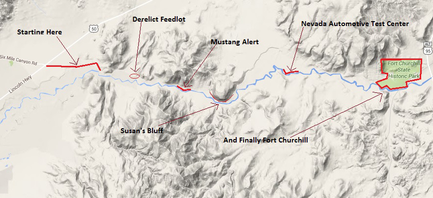
Ok, so to start this road trip, just go to the Fort Churchill
Road Map on the bottom of the right column. This will take you to
another page where you can click on any
point on the map.
It's easy, any cave man can do it!
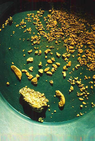
Alaskan gold grains. Image from Wikipedia
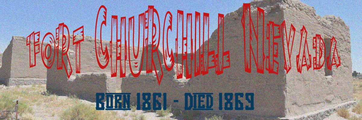
The How and Why of Fort ChurchillOn January 24, 1848 gold was discovered in the Coloma, California area during the
construction of a sawmill for John Sutter. A James W. Marshall had been
detailed by John Sutter to build a sawmill utilizing water supplied by the South Fork of the American River. While in the process of
building the sawmill Mr. Sutter discovered gold flakes or nuggets in the
tailrace water and the rest is well known history!
Thousands upon
thousands of Eastern and Mid-West Americans and along with immigrants
from Britain, Europe, China, South America and even Australia poured
into California looking to strike it rich as miners of the yellow metal.
Along with the actual gold miners came farmers, ranchers, blacksmiths,
merchants and unfortunately criminals & lawyers!
By 1860 the
USA was about to be torn into shreds as the current president, James
Buchanan, who was a northerner but who's sympathies were with the South.
Buchanan knew he would not ne re-elected as a Democrat president due to
his Southern (Slaveholding) sympathies.
A quote from
Wikipedia:
All Buchanan wanted to do was safely get out of office, so in 1860
he declined to seek re-election. In 1860, these issues broke the
Democratic Party into Northern and Southern factions, and a new
Constitutional Union Party appeared. In the face of a divided
opposition, the Republican Party, dominant in the North, secured a
majority of the electoral votes, putting Abraham Lincoln in the
White House with almost no support from the South.
The turmoil in the East only lead to more settlers coming across the
Great Plains and Rocky Mountains to California (and Oregon also,
remember the Oregon Trail, but that is another story). The High Sierra
Mountains was the last major impediment for the pioneers & settlers. In
the spring of 1849 a group of "frontiersmen" heading to California from
Salt Lake City stopped at the Carson River near to the present day
location of the town of Dayton, NV.
In this group of
"frontiersmen" was a fellow named Abner Blackburn who decided to take a
breadknife and pie pan and walk into one of the many ravines in the area
to look for gold. The pack train that Abner Blackburn was accompanying
had to wait here for the passes through the Sierra Mountains to clear of
heavy snow before
heading to "golden" California. What else was their to do while he
waited for the snow to melt!
Yes, Mr. Blackburn found gold and when
his camp buddies were told of his discovery all went out with Mr.
Blackburn and together found about 9 or 10 dollars worth of gold. Mr.
Blackburn and his pack train buddies could not stay and had to leave but
it did not matter as the news was out, Nevada (still a part of the Utah
Territory in 1849) had gold.
Jump to the year of 1860, and the
fear of (not actual attacks) Indian attacks was at its peak in the North
Western area of Nevada.
Rumors of Indian atrocities at
Williams Station
AKA Honey Lake Smith's, a Carson River outpost about 30
miles east of Carson City. As the surely hyped news reports filtered back to Carson Valley settlers,
the calls went out demanding immediate protection from the huge force of
"savages".
The original Williams Station/Honey Lake Smith's was
inundated by the newly formed Lake Lahontan (technically a reservoir) in
1912. A rather interesting and different view of the Honey Lake Smith's event can
be found here:
http://www.forgottennevada.org/sites/williams.htmlThis page also
has some very unique photographs of Honey Lake Smith's when the Lake
Lahontan was in an extremely low water condition due to the ongoing
Western drought.
We can pick up the story here from the Fort
Churchill brochure:
Actually, the so-called Pyramid
Lake War began on May 12, 1860 when three white men living at Williams
Station kidnapped and held prisoner two Indian girls. Their action and
refusal to release the girls led to reprisals by the Indians who killed
the three men, released the girls and burned the station. Rumors
magnified both the number of whites killed and the number of Paiutes
thought ready to move against white settlements. Hasty and ill-conceived
plans resulted in the movement of 105 volunteers to Pyramid Lake to
avenge the deaths of the white men.
In the battle that ensued,
the out-numbered whites suffered a major defeat. They lost two-thirds of
their original force. The Indians decisive victory led to immediate
white retaliation. Urgent calls went out to California for regular army
troops. The troops, bolstered by additional volunteers, moved against
the Indian forces in early June. In this second battle, the out-numbered
Indians were forced to retreat. Casualty reports ranged from four to 160
Indians killed while only two whites died.
Williams Station was a Pony Express station kept by James O.
Sullivan along the Carson River between stations 149 (in the
Carson
Sink) and 151 (Hooten Wells Station) (cannot locate on any map). The ruins were inundated by the
Lahontan Reservoir created by the 1911 Lahontan Dam and were visible
during a 1992 drought. This Wiki information may be incorrect for the
location of Stations 149 and 151!

Capt. Joseph Stewart, Fort Yuma, CA in 1858. Image Wikipedia.
In December 1859 Captain Stewart took command of Fort Alcatraz,
later to be known as Alcatraz Federal Penitentiary. In the years
immediately preceding the Civil War, Captain Stewart transformed Fort
Alcatraz into one of the most powerful coastal defense in the Western
USA. It was also during time that Alcatraz took on the role of a prison.
Under Stewart's command 11 soldiers were imprisoned there and later
other nearby forts were sending prisoners their prisoners to be housed
in Fort Alcatraz.
The U.S. Army responded by sending a detachment
of U.S. artillerymen (no cannons) and infantry from Fort Alcatraz,
California to the Carson River area of what would become the state of
Nevada. This contingent was known as the "Carson River Expedition" and
was led by Captain Joseph Stewart.
Captain Stewart along with
Colonel John C. Hays, a retired Texas Ranger, who had organized a force
of local volunteer militia known as the "Washoe Regiment" defeated
Numaga and the Paiute forces were scattered across the Great Basin. This
was the Second Battle of Pyramid Lake.
After the second battle of
Pyramid Lake, the federal forces built a small fort at the southern end
of Pyramid Lake. In 1861 the fort at Pyramid Lake was abandoned in favor
of Fort Churchill.
Picking up the story again from the Fort
Churchill brochure:
Captain Joseph Stewart
and his Carson River Expedition were then ordered to establish a post on
the Carson River. Starting July 20, 1860, tens of thousands of dollars
were spent to construct Fort Churchill, the desert outpost that guarded
the Pony Express run and other mail routes. Hundreds of soldiers were
based here between expeditions against the Indians.
The fort was
named in honor of Sylvester Churchill, the Inspector General of the U.S.
Army. It was built as a permanent installation. Adobe buildings were
erected on stone foundations in the form of a square, facing a central
parade ground. The Civil War made the fort an important supply depot for
the Nevada Military District and as a base for troops patrolling the
overland routes.
By 1869 with the Pony Express mail service having ended and with
the completion of the transcontinental railroad the fort was abandoned.
The adobe buildings were auctioned for a sum of only $750 having cost
the American taxpayer a couple 10,000 dollars!
Samuel Buckland was a pioneer
rancher/farmer who used the nearby waters of the Carson River to
irrigate crops of fresh vegetables, barley, hay and other supplies,
including cattle, to western emigrants and Fort Churchill staff during
the 1860s.
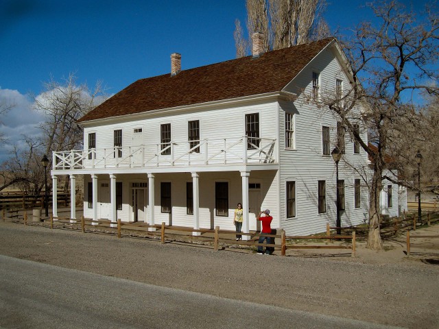
Buckland House.
Image from Nevada State Parks
Samuel Buckland had moved west from Kirkersville, OH
in 1850 along with the mass movement of people looking to get rich in the California Gold Rush.
I guess Mr. Buckland never actually made it to California because in 1859, he
purchased land near the Carson River in an area called Pleasant Grove.
Soon, his ranch became a stop for the Overland Stage. Then in 1860, he
had signed a contract with Russell, Majors and Waddell (Founders of the
Pony Express) to become a Pony Express station.
In 1860,
Samuel Buckland married Eliza Prentis. Together, they had eight
children; but only three of the children survived into adulthood which
was not uncommon in the pioneer West.
The post cemetery still had
it's dead intact until 1884 when the remains of soldiers buried in the
post were moved to Carson City. Today you will still see graves in the Fort
Churchill post cemetery, but these are the graves of the Samuel S.
Buckland family.
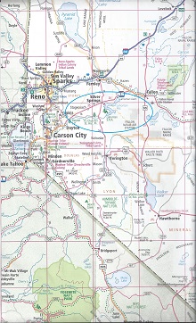
Navigation Map
Yep I know, the map is really jus a
bit to small to see what you are clicking on.Not to worry folks, just go
ahead and click on the map itself and boom of you go to the Navigation
Page. So simple even a cave man can do it!
Fort Churchill Road
Derelict Feedlot
Mustang Alert
Nevada Automotive Test Center
Historic Fort
Churchill
Bibliography
http://daytonnvhistory.org/gold.htm
https://www.coloma.com/california-gold-discovery/
https://www.nevadamining.org/nvmablog/2012/01/05/early-nevada-mining-history-1859-1919-how-an-industry-created-a-state/
wikipedia
http://parks.nv.gov/parks/fort-churchill-state-historic-park/buckland-station/
http://emigranttrailswest.org/wp-content/uploads/2010/09/The-Marker-Fall-2011.pdf
Google Maps
http://www.octa-trails.org/regional-chapters/california-nevada
http://emigranttrailswest.org/wp-content/uploads/2010/09/The-Marker-Fall-2011.pdf
http://emigranttrailswest.org/virtual-tour/carson-trail/
http://www.solidearth.co.nz/adobe-brick-technique.php
http://desertphile.org/adobe/brick.htm
http://jeffarnoldblog.blogspot.com/2012/11/attack-that-fort.html
http://www.ndow.org/uploadedFiles/ndoworg/Content/Nevada_Wildlife/
Animals/Concerns/NV_Ven_rept.pdf