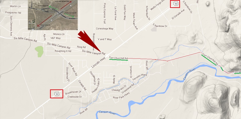
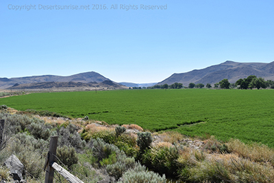
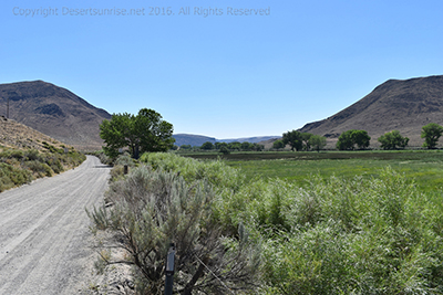
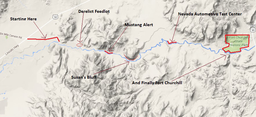
At the beginning of the Fort Churchill road just after turning of US
50. This view is to the West. The Carson River along with the tree line in the
background. The road is unpaved and almost all the distance the road full of
powdered fine dirt from all the vehicles traveling up and down the road.
But then again the SMOG that coats my vehicle after just 1 day in Los
Angeles is far nastier. Smog residue has a slight glue content plus copious
amounts of Pigeon & Raven droppings. So do not let a smattering of Nevada
dust discourage you from taking this route!
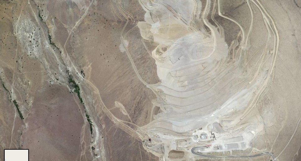
Looking around the east end of the Dayton valley I spied this man-made
scar to the north of US 50. Simply ugly. But I guess it is the price we have
to pay for thousands of miles of freeways, strip malls and multi-storied
parking structures! The Scar is at 39.339250,-119.521708.
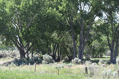
The Carson River flows along through this small
valley and a portion of it's flow is diverted by a couple of irrigation
canals labeled ditches on the Google Maps that I used. This diminishes the
flow of the Carson River but also provides some of the water for the alfalfa
fields that can be observed throughout the trip.
It was the July 4th
Weekend and yes it was hot. Hovering at around 98 degrees during the day.
Warning! Always take plenty of water when
traveling in the deserts and mountains of the American West ! Nuff said?
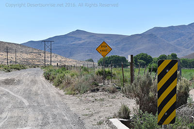
Nevada is one of those states that has open ranges. What this means is that
at times and especially after you see a road sign as the one above, you might very well
encounter cattle, horses, sheep and politicians grazing on the range so
beware they are NOT fenced in and can thus cross the road at any time and ask for
your vote and a dime.
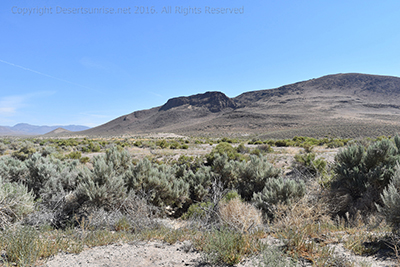
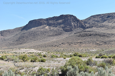
Unfortunatly I did not see any open range
cattle on this portion of the trip. Below are 2 images of the same rocky
hill the one on the right is simply a close up with a telephoto lens. Rugged
terrian indeed!
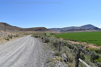
This portion of the Fort Churchill road was across the fields from
the Carson River. The 2 photos is montaged together would form 1 image. You
can tell by the looking at the fencepost with the crossbeam on the bottom
right and left of the photos. I do love my Nikon 5500 DSLR camera but it did
not come with built in GPS. I chose the slightly cheaper model and now I am
paying for my decision.
I was able to
come up with an approximate coordinated position by using some creative
Sherlock Holmes deduction techniques. By looking at the above left image and
comparing the road, fields, hills to the left and the telephone pole off to
the left side of the road with the single telephone pole in the center of
the photo on the right and then finding that exact same location on Google
maps (satellite).
I finally came up with this GPS:
39.295627,-119.474040. All that work and time to do what a $150.00 to
$250.00 GPS addon will do. The red circle indicate the location. I am saving
my quarters now!
I love this photo on the right as it reminds me somewhat of Sicily in the
1980's. I cannot rememer where on the road I actually took the photo except
it was on within the first couple of miles from the begining of the drive.
The Carson River is still on the other side of the fields.
The photo below is the same time and direction as the photo on the right.
The photo on the right was using the telephoto lens. This was a clear sunny
day without much haze or dust except when vehicles drove by.
The Carson River does not have a high
capacity flow of water. I believe it's maximum flow in spring is around
1,000 cubic feet per second. The rest of the year it probably flows around
200 to 300 cubic feet per second. Some of the farms probably supplement
their water allotments with well water. This farmers irrigation water pipe
was leaking badly, but this sound of the water gushing out, a slight breeze
blowing and the birds singing gave a very peaceful moment of solitude. Fairly easy find on Google maps. GPS: 39.299872,-119.488240.
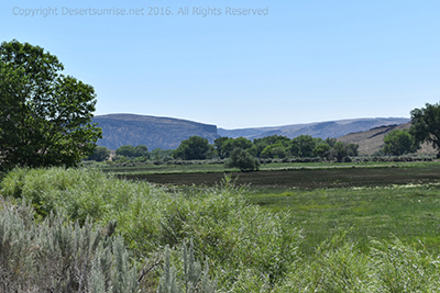
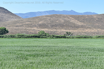
Below we again can see the amazing contrast between the green fields, tan
hills and the darker mountains in the far background and that all topped of
by a light blue sky.
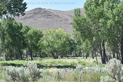
Next, as the Carson
River meandered closer to the road I got a closer look at what is called a
Riparian Zone or Riparian
Woodland. This is
simply a zone where a river or stream flowing through a desert, savannah,
plains or a steppe allows plants, trees, bushes to grow that the desert
environment would not otherwise support. These "green zones" are a very
important portion of many of the animal life in these parched environments.
The Nile River in North East Africa is a prime example of a Riparian Zone on
a huge scale though.
Continue the journey
along the Fort Churchill road. I promise you that we will get to the fort
eventually no matter what is thrown in my path. The image at the bottom of
the page will take you to another page where you can choose what portion of
the road trip you want to view.
Navigation