Wednesday, September 12, 2018 7:13:36 AM
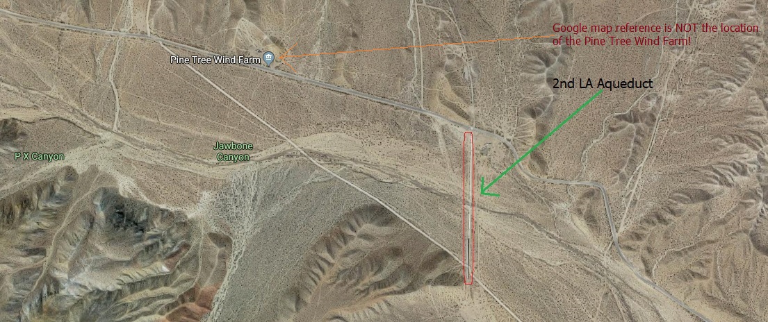
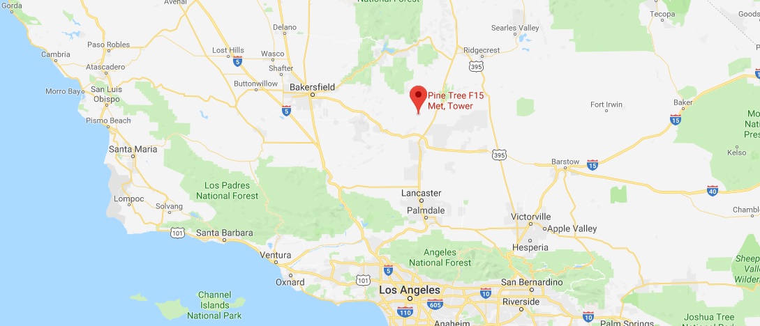
Pine Tree Wind Farm
Mankind has been harnessing the
power of the wind for many millennia now. From windmills used to mill
grain to sails for ships to windpumps and even chafing grain, wind was
and is a free but unreliable power source. Modern industrial man almost
completely forgot about the wind being used as a power source during his
mad love affair with carbon based fuels. Now in the current era we find
ourselves at the mercy of oil cartels, environmentalists, power hungry
politicians, greedy automobile companies and a very spoiled population.
So now in the 2000's both solar power and wind power have become
popular to the point that many people see both solar power and wind
power as our salvation for our
mobility freedom and independence from foreign oil/natural gas exporting
nations.
Public mass transportation in America is still a curse word
and far too much of the population still considers public mass
transportation as a device for getting the poor to government medical
hospitals, Federal Aid centers and the local unemployment office! How
totally lame and ignorant. See the
Quick Facts PDF to
refute this idea.
But fear not the wind is blowing up a
storm and with it's sister solar power all will be saved! But at what
cost? How many mountain ridges will be converted into wind farms? How
many farmers will give under to the quick deal of cash so that their agricultural
farms (used to feed the
ever growing US population) can be plowed under to be re-made in wind/solar farms? How much of our
western desert can be converted into solar power farms before the entire
western desert looks like a massive aluminum stain across our landscape?
With those thoughts in mind let's go visit a wind farm in Southern
California.
Many a traveler along the California State Route 58
going either Eastward or Westward through the Tehachapi Mountains
between Mojave and Tehachapi will see a
mass of wind turbines among the
hills. This is the famous Tehachapi Pass Wind Farm. Back in the mid
1980's when I first traveled by motorcycle through the Tehachapi Mountains
the wind farm was almost entirely concentrated on the mountains to the
south of the freeway between the Sand Canyon road and the railroad
overpass. Only a hundred or so wind turbines could be seen from the
freeway. Now a third of a century has passed and the wind turbines have
multiplied like weeds and have grown all over the Tehachapi Mountains almost down into the
town of Mojave itself!
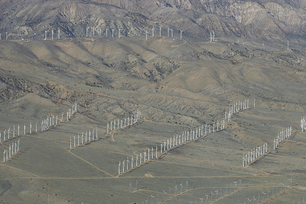
Tehachapi Wind Farm (via Wikipedia) showing how the wind turbines
over the years have moved down the mountain side towards Mojave.
Presently the Tehachapi Wind Farm has about 4,730
plus wind turbines and altogether (maybe a dozen different companies) produce about 3,200 plus megawatts of electricity.
Nice! But the Tehachapi Wind Farm has a significant amount of older
kilowatt type wind turbines. What about a newer more current wind farm?
Going east from Tehachapi Wind Farm, along the southern Tehachapi
Mountains paralleling the SR 14 is another wind farm that is set back
further into the mountains. Originally known as the Pine Tree Wind
Project but now that the LA Department of Water and Power owns the
facility the official name is Pine Tree Wind and Solar Farm.
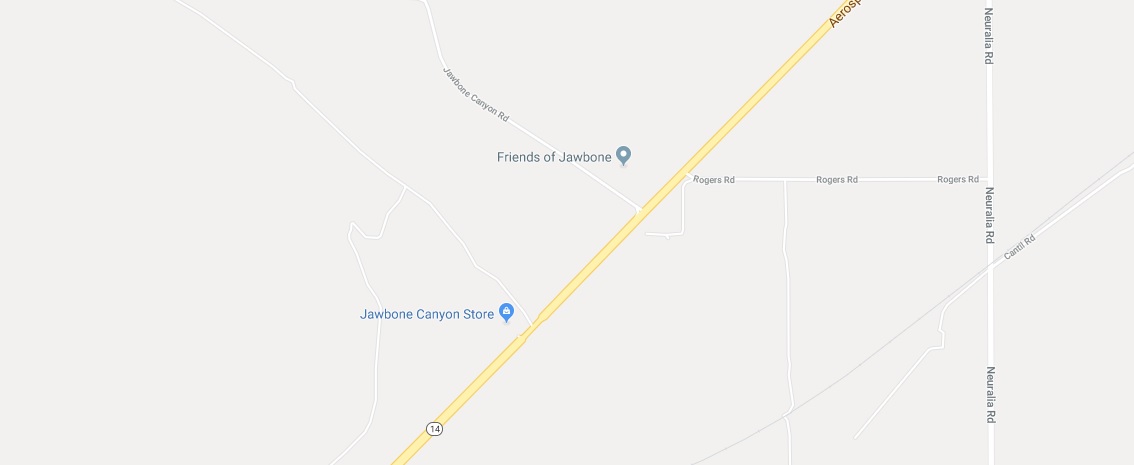
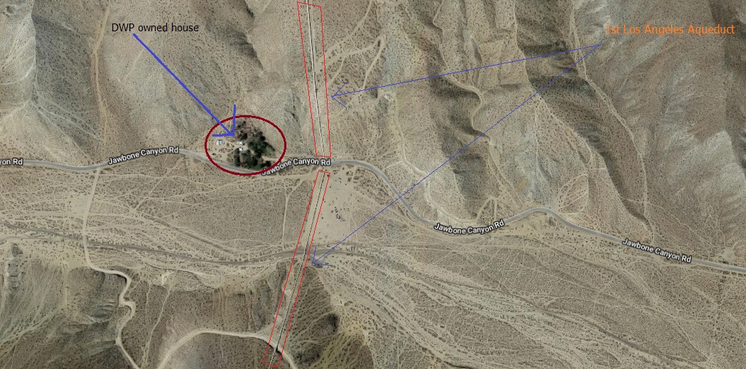
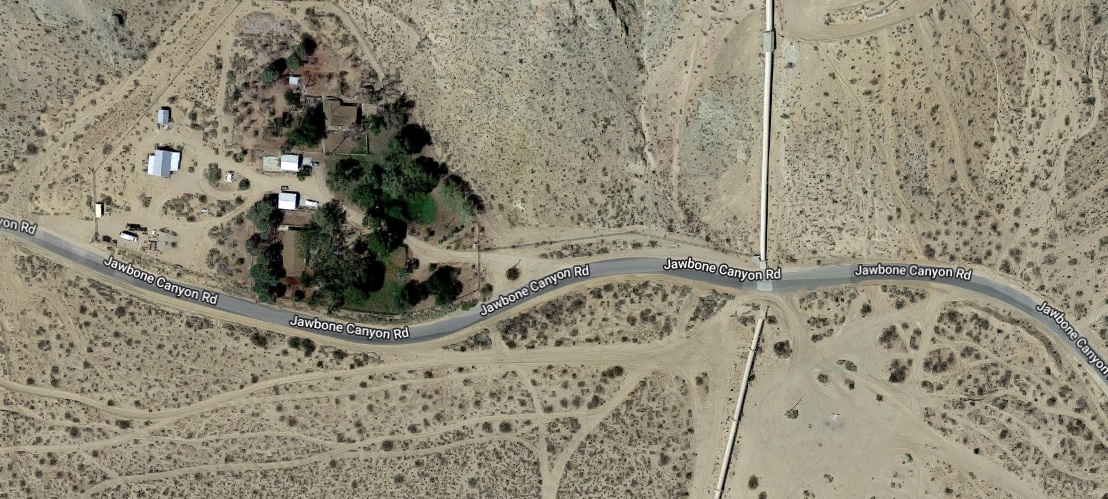
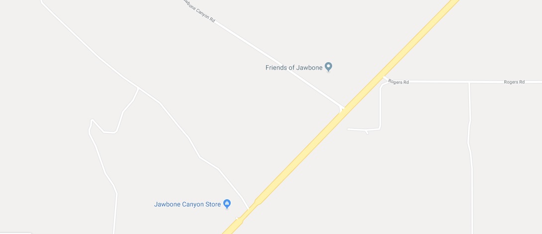
Access to the Pine Tree Wind and Solar Farm is normally via the Jawbone
Canyon road which runs through, you guessed it, Jawbone Canyon!
Where did the name "Jawbone Canyon" originate? And where is this Jawbone
Canyon? European Americans (distinct from Native Americans) possibly
named the canyon Jawbone due to the shape of the canyon acording to the
Wiki.
"Europeans first settled in the canyon around 1860—naming it Jawbone
because its shape resembled a mandible"
Really? But I have sincere doubts about this version for the naming
of the canyon. So I am to believe that in 1860 the shape of the canyon
was determined by what I imagine were a pack of European Americans gold
rush miners, mule skinners, or prospectors climbing to the peaks of a
dozen or so hills that surround
Jawbone Canyon and then promptly after
each hill climber was finished viewing his section of the canyon
proceeded to huddle up with his peers and produce a composite map using
pencil and paper that every miner carried in abundance!
I think
the Myth Busters would blow up this myth quickly. Jawbone Canyon was
probably named as such by one miner telling his fellow miners
to just "follow my trail which will be littered with the jawbones of my
dead mules cause I cannot find water anywhere"! Just my late night
convoluted thinking.
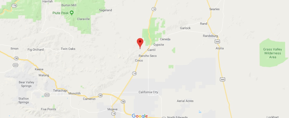
So Jawbone Canyon is located in the south eastern Tehachapi
Mountains just north of the SR14. The canyon was most likely made over
many millennia by the Jawbone Wash, which is normally a dry wash. I am
told that during winter and early spring a trickle of water may flow
through the wash. A heavy summer downpour could lead to a flash flood
through the canyon.
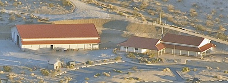
Jawbone Station Visitors Center, photo from the Friends of jawbone website.
First off lets get 1 item straight! Especially for the moron who
penned a www.skyscanner.com review in 2017 stating:
"This blase ranger station is the worst facility of this type that I
have ever been to."
"The primary reason to come here
apparently is to get permits for ATVs n dirt bikes n maybe camping
but that wasnt clearly disseminated from the volunteer staff member
who i had to ring a bell for and it took about 5-10 minutes for her
to show up".
This is NOT a federal or state run "ranger station" but is a
privately run visitor center
manned by volunteers from the Friends
of Jawbone! And on another note, when I visited the Jawbone Station Visitor
Center in September of 2018 I found the site clean, manned by a nice
fellow who let us know that in 10 minutes he would be closing the shop
and asked us if we needed any assistance before he started to close up
his booth.
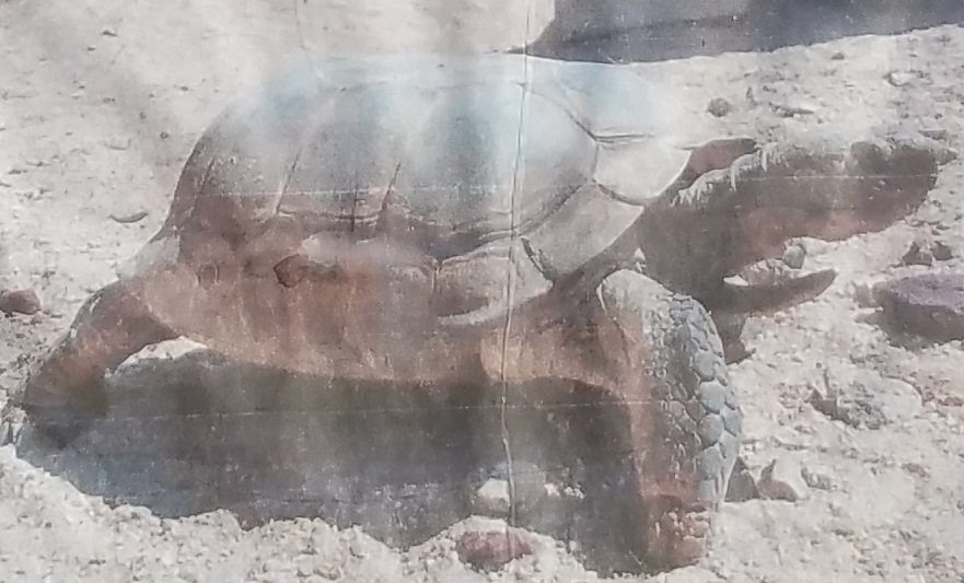
Outside the front entrance of the Jawbone Station
Visitor Center you might get a chance to meet
"Bob" if you are there
late in the evening. Bob is about 120 years old and is a Western Mojave Desert Tortoise
who has been working as a mascot for the last 18 years!
1 / 8
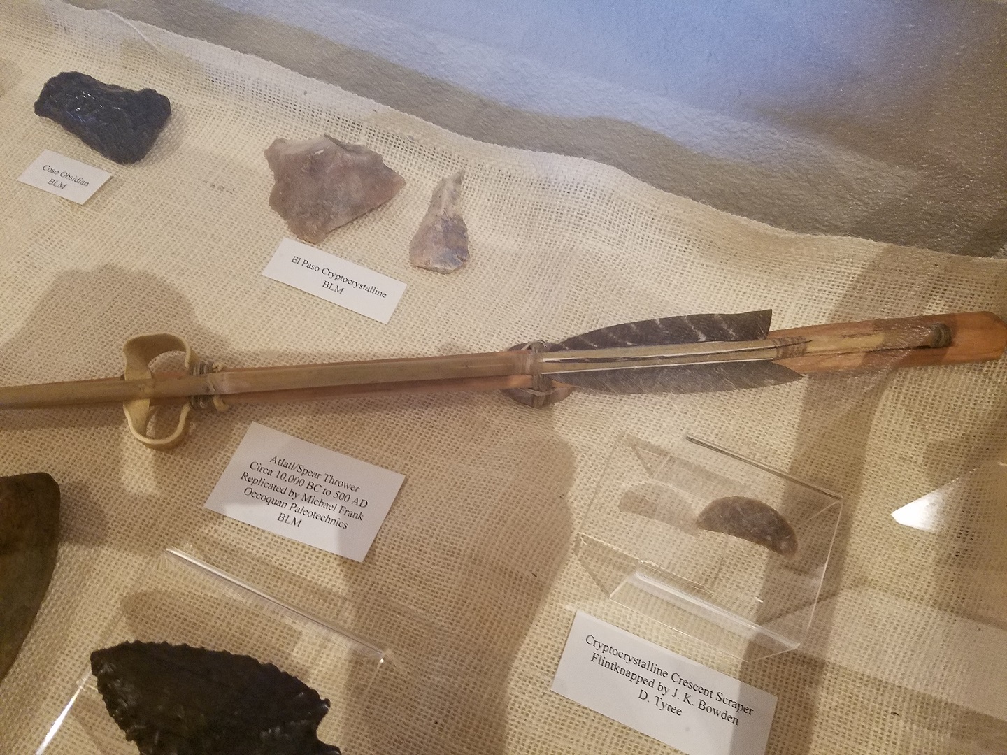
Arrow and Arrowheads
2 / 8
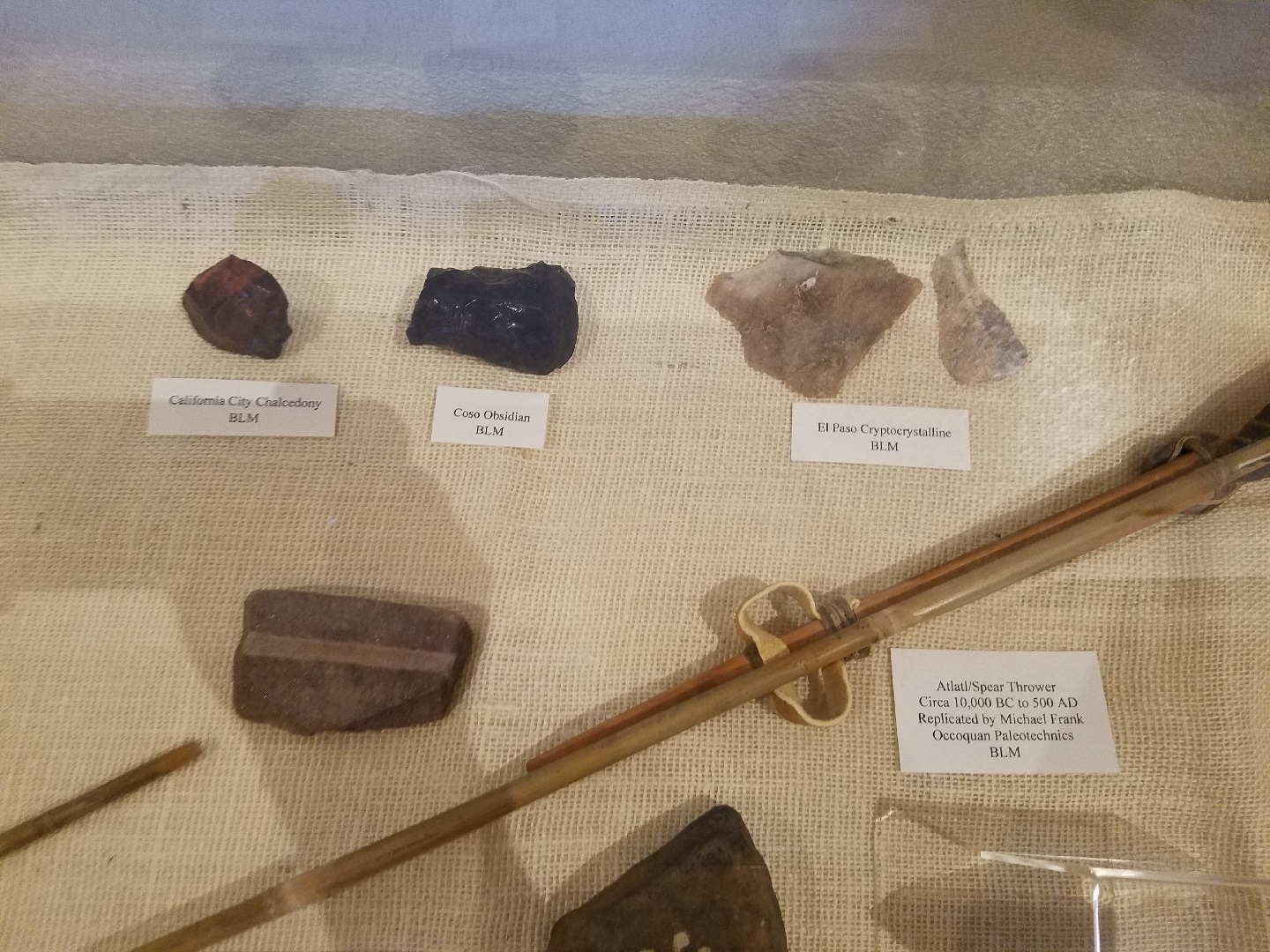
Rocks and Atlatl
3 / 8
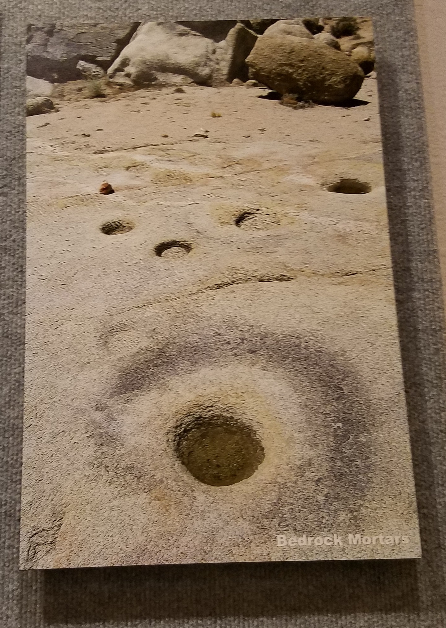
Bedrock Mortars
4 / 8
Desert Tortoise
5 / 8
Animal Diorama
6 / 8
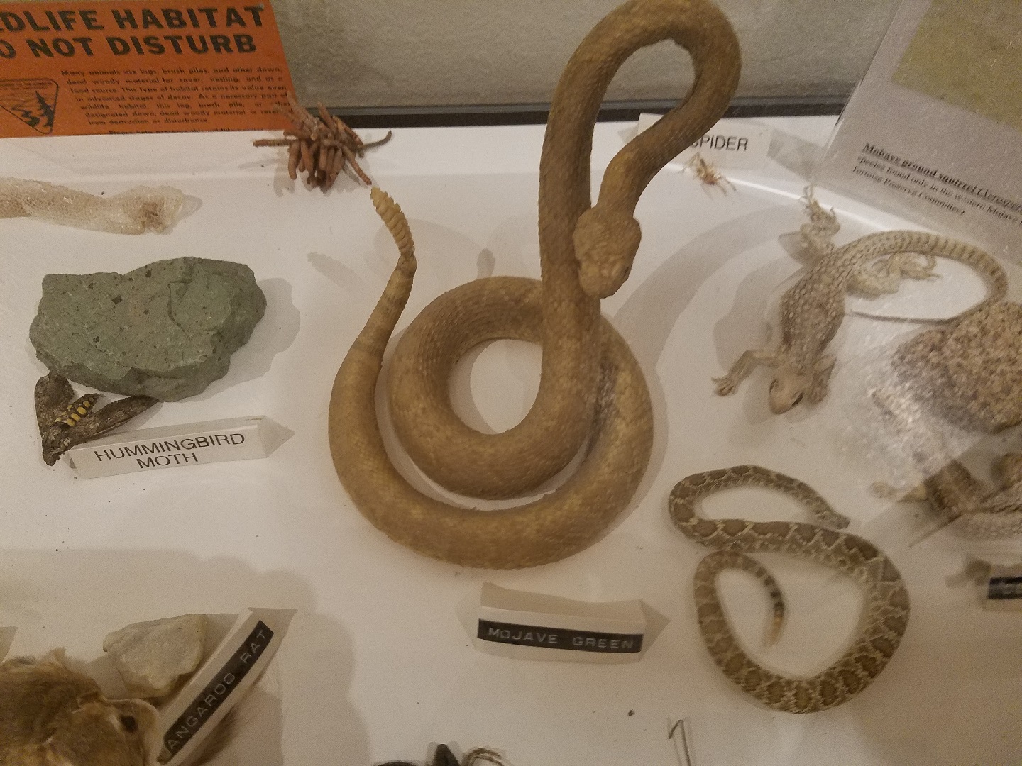
Snakes and Lizard
7 / 8
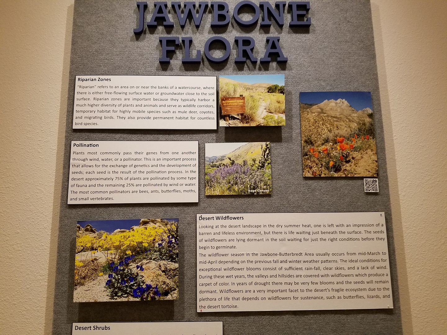
Jawbone Flora
8 / 8
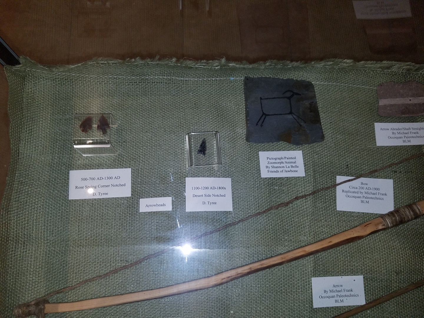
Bow and Arrowheads
❮
❯
Next we can start our journey up the Jawbone Wash on a Jawbone Road which goes from paved to dirt and back a few times
ultimately ending up as a un-paved dirt road. Jawbone Canyon Road can
thus be considered a roughly graded dirt road with patches of pavement
in the lower elevations that ultimately connects the desert areas of
Jawbone Canyon with the pine-covered Piute Mountain region which is
about 38 trail miles away in the Sequoia National Forest.
Our
journey only goes about 1/4 of this distance!
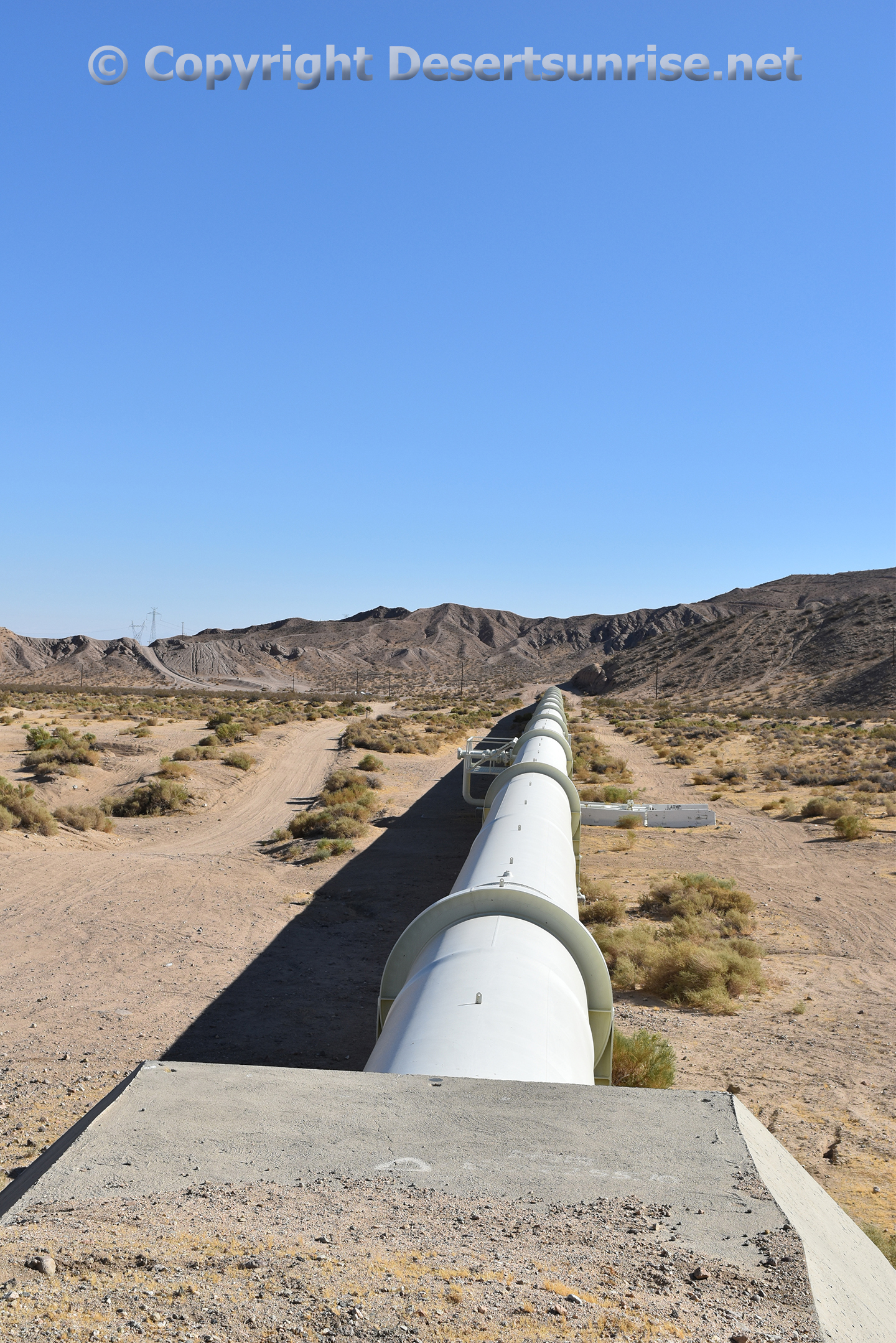
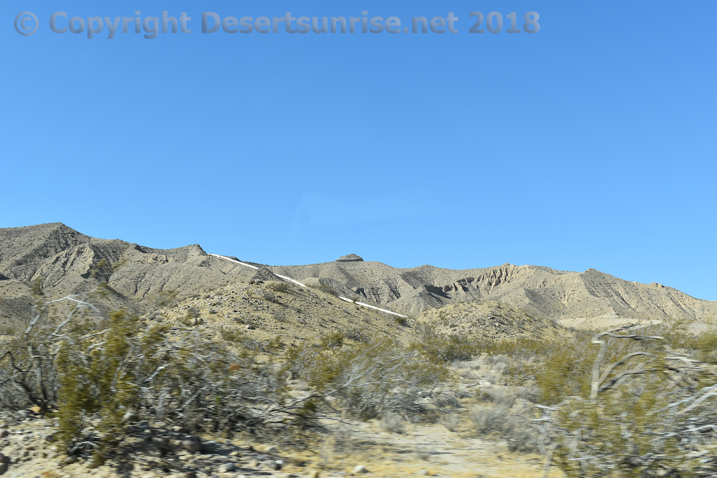
About 2 1/2 miles
or so from the Jawbone Station you will see this whitish tube snaking
across a ridge! This is part of the L.A. Aqueduct coming down from Owens
Lake.
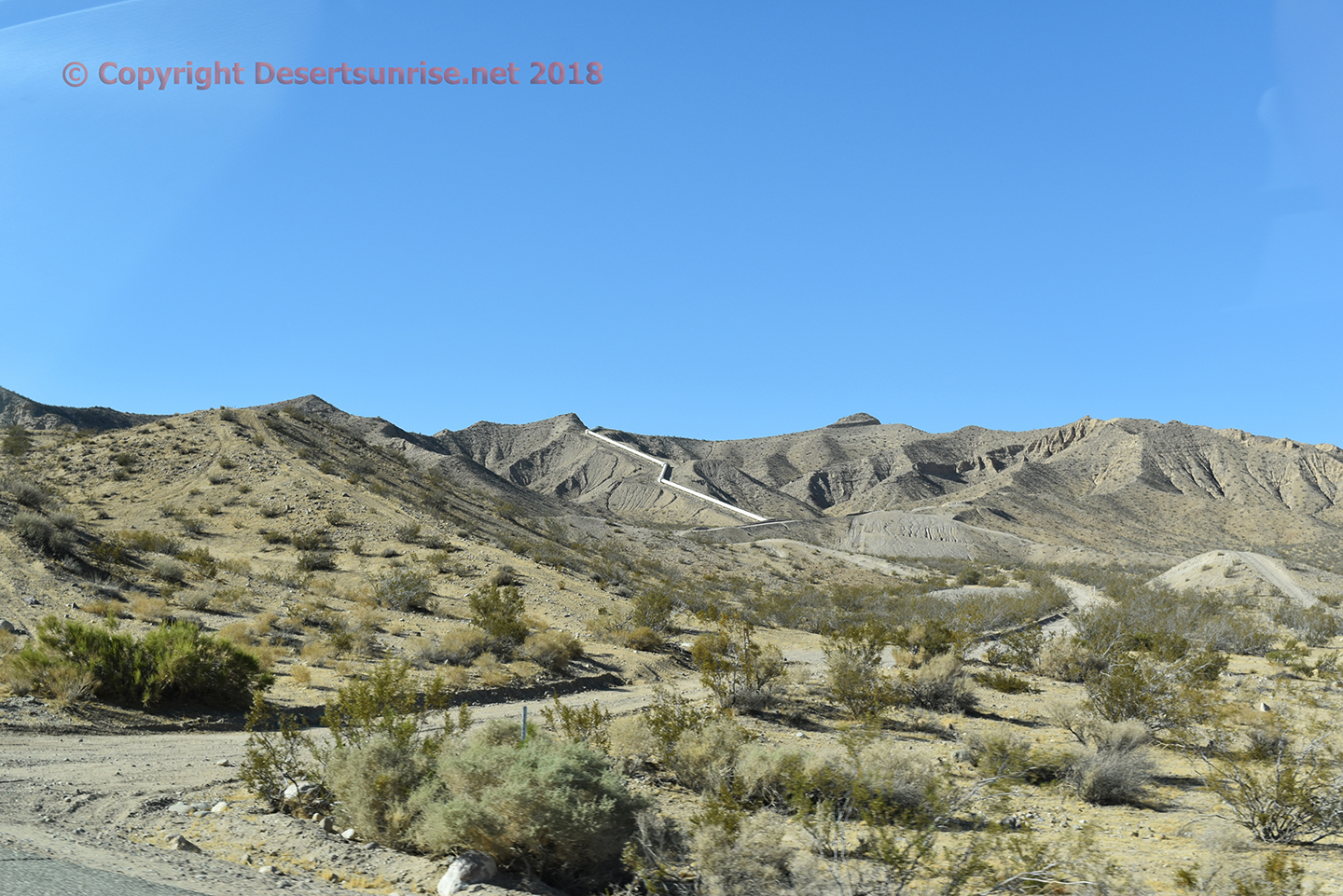
Jawbone Road at LA Aqueduct. Plant life here is a mix sagebrush,
creosote, pinion and maybe cheatgrass.
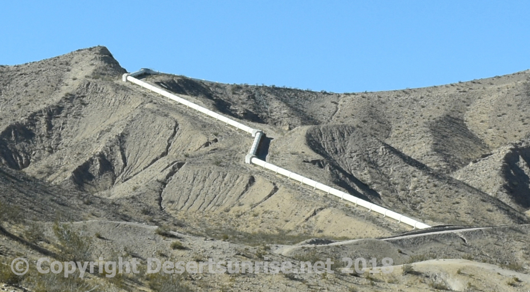
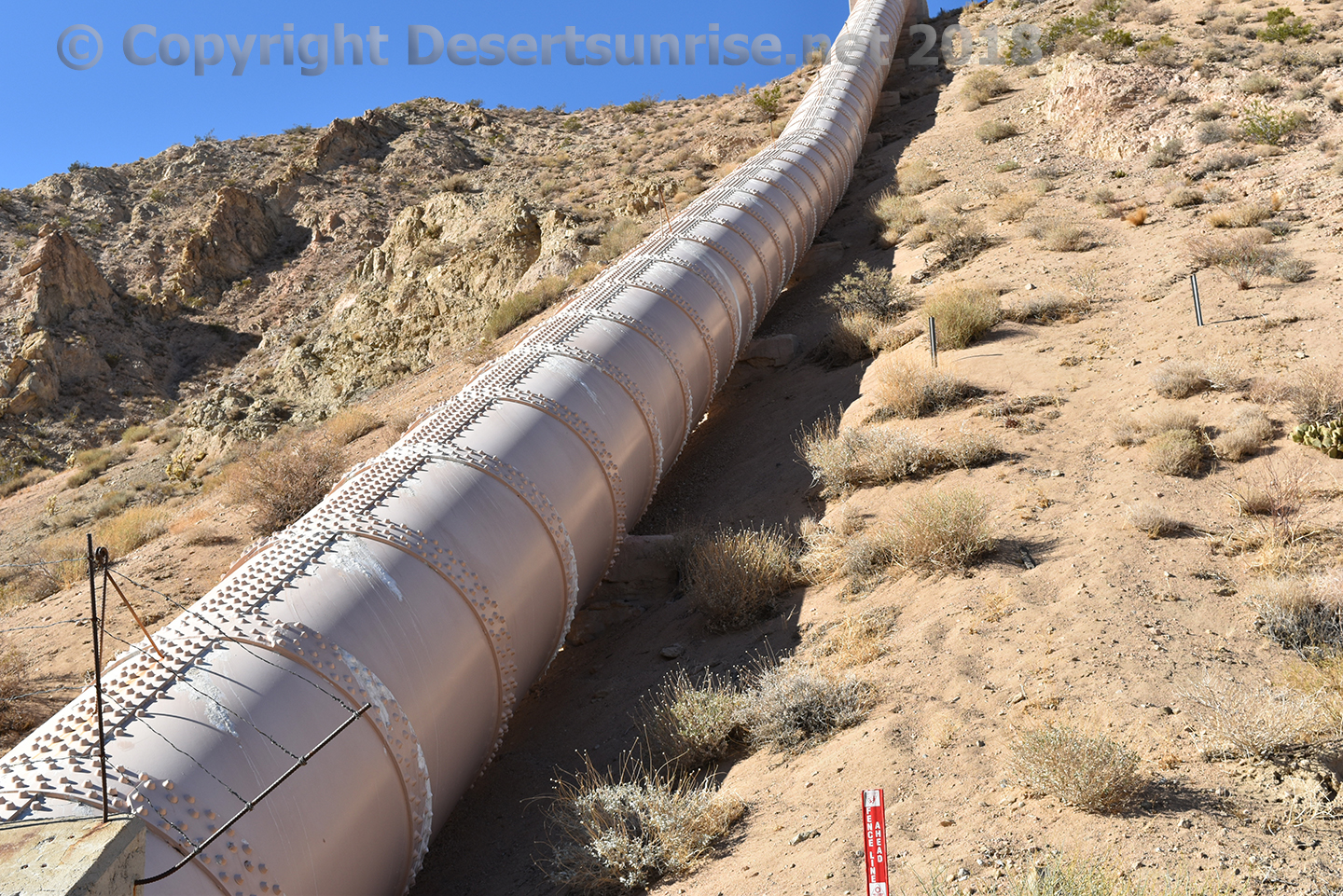
Los Angeles Aqueduct at Jawbone Road
This is the 2nd of 2 aqueducts that the City of Los Angeles (DWP)
built to remove most of the available water from the Owens Valley. The
city of Los Angeles through it's DWP began a five-year construction plan
in 1965 to build another 137 mile aqueduct to remove even more water
from the Owens Valley. The cost of the second aqueduct in 1965 dollars
was $89 million. Today that cost would be approximately $713 million!
Three items to notice in the above 2 photos:
1. The electrical
power lines seen to the upper left in each photo are NOT from the Pine
Tree Wind Farm but used at this point for the Beacon and Barren Ridge
solar farms on the south side of the hills.
2. The aqueduct pipe
itself has a water spigot and some form of catchment basin under the
tube. Cannot find out what exactly this is. In the distance the aqueduct
goes through the hills and then parallels the SR 14 highway until past
Mojave.
3. Notice the hill to the upper right and to the left of
the DWP dirt road going over the hill. OHV vehicle destruction can be
easily seen. Are these trails that the OHV riders are supposed to follow
or as one would expect that the
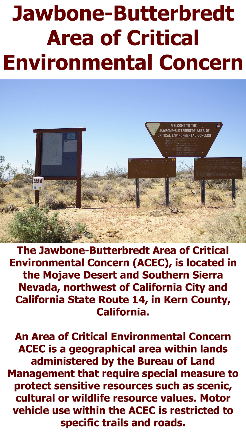
Jawbone-Butterbredt ACEC and the Jawbone
Canyon Off-Highway Vehicle Area are 2 polar opposites and the
Jawbone-Butterbredt Area of Critical Environmental Concern is a
horrible joke!
Above is a snapshot of the Second LA Aqueduct as it comes over the hills
from the north. This is mid 1960 engineering tech. Later you will see
early 1900's engineering tech of the original LA Aqueduct. You can see
this feature from outer space!
This is the first Los Angeles Aqueduct built in the early 1900's.
The project was approved by bond measure to the tune of $23 million
(Wiki states $24.5 million). Today that would be $586 million or more!
The project started in 1907 and completed in 1913. Primarily
engineered by William Mulholland and helped by former Los Angeles mayor
Frederick Eaton.
The unbelievable irony here is that Los Angeles
DWP now has to maintain this water thieving pipeline against the same
people who use this area as a off-road vehicle playground who when
finished with their "weekend warrior desert destruction" cycle head back
down to Los Angeles to wash off their ATV's, water their lawns and then
finally wash the desert dust off their trucks and vans using the same
water that comes down through this pipe!

The above left photo shows 1 of the devices used to keep vandals and
motocross riders off the aqueduct pipe itself. The above right photo
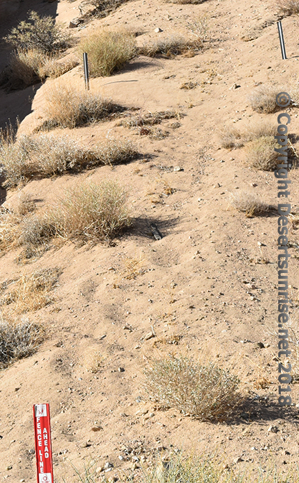
we see a red sign post on the bottom left that states "Fence Line
Ahead" which I imagine is required by law to inform ATV riders to
NOT proceed up the hill or they might get de-capitated by the wiring
of the fence. But if you look closely you will not see any wires or
cables!
"TRAIL RIDING OUTSIDE THE OHV AREA: Outside of the OHV area and
within the Jawbone-Butterbredt Area of Critical Environmental Concern
(ACEC), motorized vehicle use is restricted to a specific designated
road and trail network. All cross-country travel is prohibited in these
areas, and the designated routes are marked with brown trail markers.
You may only use the designated route network -- all other trails are
closed -- even if you do not see a red closed sign."
RESEARCH ON OFF-HIGHWAY VEHICLE EFFECTS
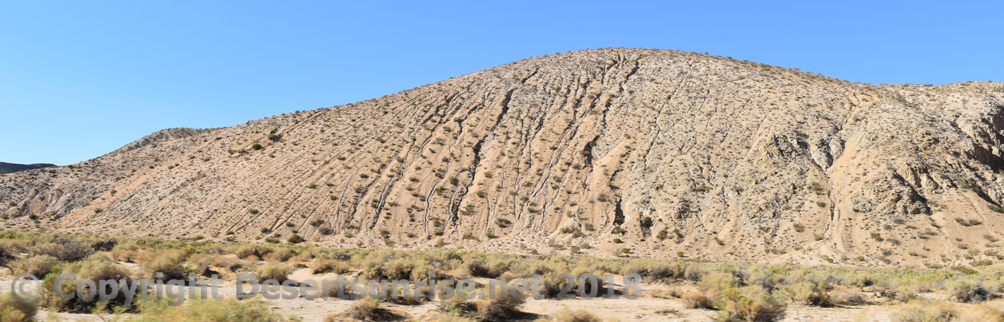
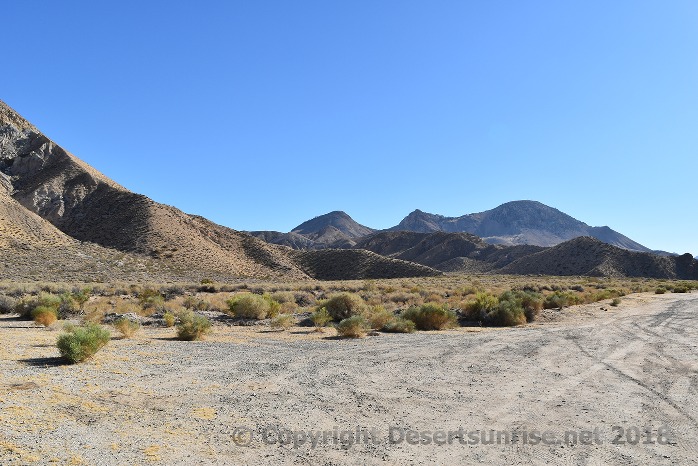
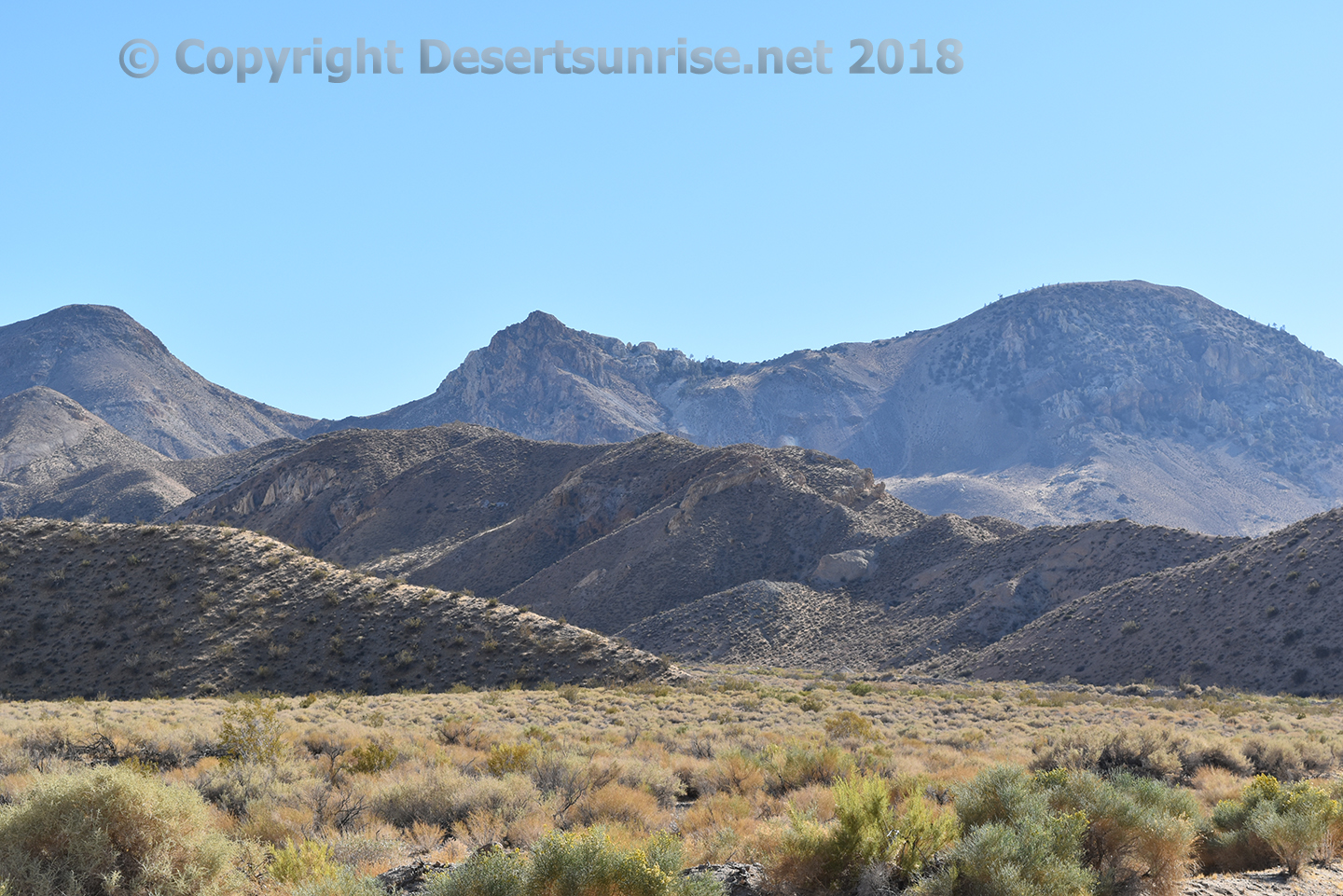
Moving further up the Jawbone Canyon in the wash you will notice that
the brush is thicker. Mostly likely due to the greater amount of water
the plants receive here compared to plants on the hills beyond. This
might be the Artemisia
Tridentata type of sagebrush. But in reality it is
Rabbitbrush!
Artemisia Tridentata — Big
Sagebrush
Big sagebrush gets its name from its stature and its
relation to members of the sagebrush group. Artemisia (ar-tay-MIS-ee-a)
is from Artemisia, wife of Mausolus, ancient ruler of Ceria (southwest
Asia Minor). She was named after Artemis, the Greek virgin goddess of
the hunt and wild nature. Tridentata (tri-den-TAH-ta) means "three
toothed," in reference to the three lobes on the tips of most leaves.
Also called big sage, common wormwood or basin sagebrush.
Big
sagebrush is the most abundant and widespread of all the species of
sagebrush. Big Sagebrush has four distinctive subspecies, each with
multiple geographic races that are sometimes named as varieties.
Hybridization between subspecies is common, often making clear
identification next to impossible.
The fourth subspecies (4) is
Parish big sagebrush (subsp. parishii). It is similar to Basin big
sagebrush in form and habitat, except that it extends southward from the
Great Basin into the Mohave Desert shrublands, is more heat-tolerant
than the other subspecies, and it has drooping inflorescence branches
and hairy seeds.
Flowering period: Late summer to late fall.
For more information see the Sagebrush Pocket Guide from
www.sagestep.org
The fencing seen here I suppose was used to keep out vehicles and
prevent them from using the wash as a OHV area. Uhh this fence could not
keep a 6 year old on a tricycle from entering!
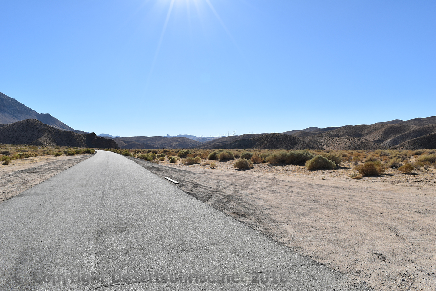
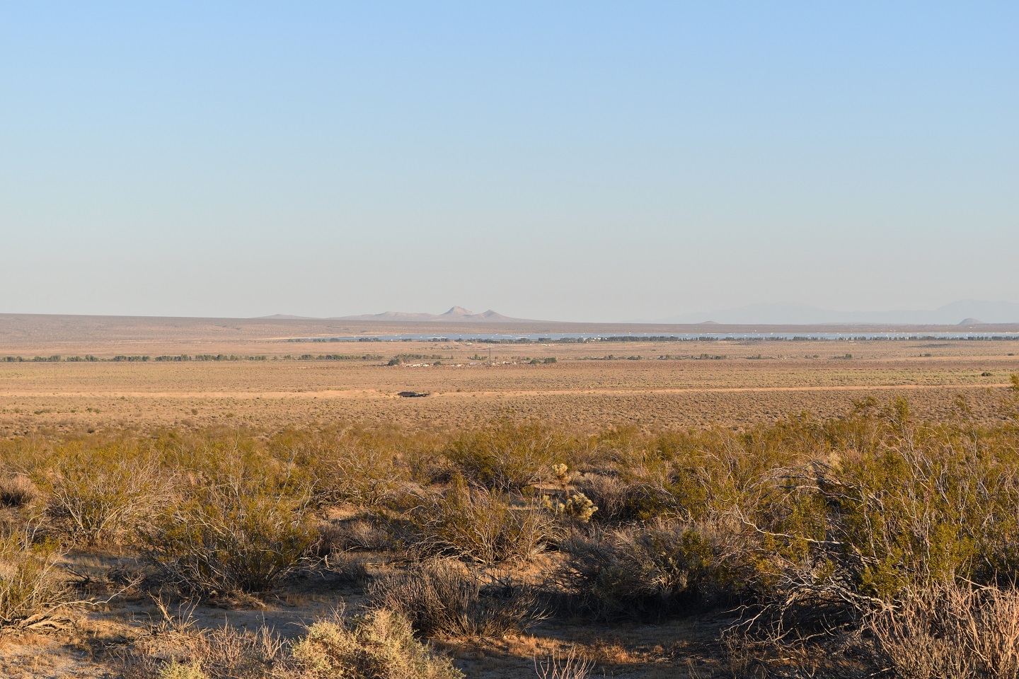
Paved portion of the Jawbone road with Wind Turbines in the distance.
The direction here is northwest. Notice that the hills are becoming
mountains.
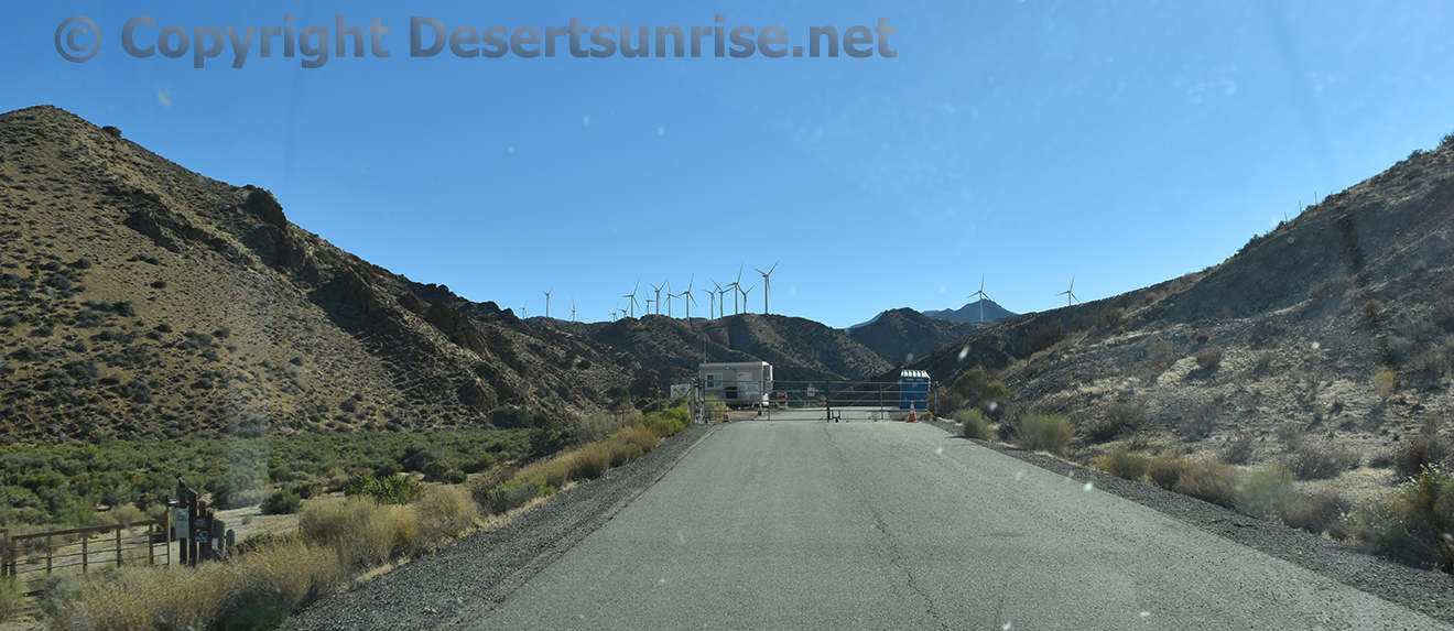
A typical guard shack or in this case a stunted trailer! Looks like
the guards have a portable electrical generator and the always useful
Port-a-Potty!
Wait. What? A portable gasoline or diesel
electrical generator will all that electricity being generated by those
wind powered generators in the background!
Notice different types
of sagebrush. The sagebrush in the wash is greener and fuller than the
bushes along the side of the road and the small bushes clinging to the
side of the hill are completely different altogether.
Nice fence
fellows, the half fence to the left that is! Uhh what is it used for?
Because it does not look as if it could stop that 6 year old kid on a
tricycle we spoke about earlier when we were further down the wash.
At this point we will need to use a Arabian Flying Carpet to see the
Pine Tree Wind and Solar Farm! So lets take a magic carpet to Part 2 of
this overly large page.
If something is amiss in this article you can always e-mail the
Desertsunrise Webmaster fellow!
Just go up to the top at the navigation section to peruse other
Desertsunrise pages.
Top

Notice please that these 3 pages will all load just a little slower
than the normal slow loading Desertsunrise pages due to the heavy
graphic content.
Again no
CHUM pages
here!
The 3 pages are all linked at the bottom of each page. Just
a second or two extra wait!
Or you can watch "Bubblegum Head"
having fun with his head!
Getting to Jawbone Wash, Jawbone Road, Jawbone Canyon, Jawbone
Canyon OHV Area and the Friends of Jawbone Station.
Below are
directions provided by:
Bureau of Land Management
Ridgecrest Field
Office
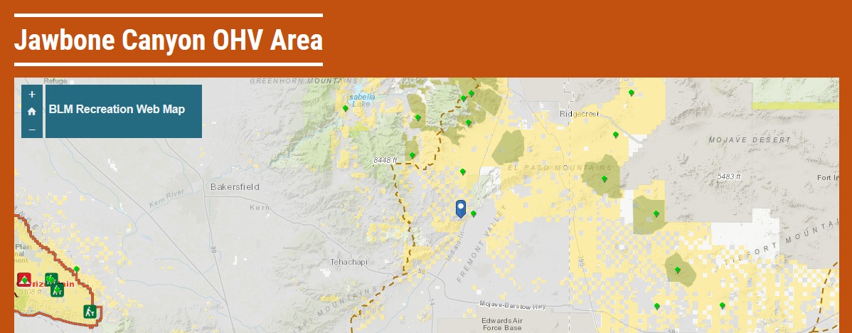
Latitude/Longitude 35.312571 / -118.050022
Directions Jawbone Open
Area is located off State Highway 14, approximately 20 miles north of
the intersection of State Highway14 and 58 in the town of Mojave. A left
turn from State Highway 14 onto Jawbone Canyon Rd., when traveling from
the south. Traveling from the north, it is a right turn onto Jawbone
Canyon Rd.
Don't get confused about the 2 very similar sounding place names.
The Friends of Jawbone Station is a volunteer manned station under
contract with the BLM. Here you will find maps and a small wall of
interesting books and a dozen or so dioramas of native wildlife and
history.
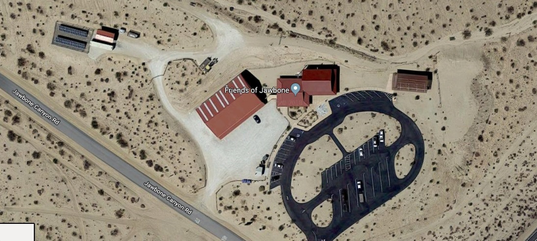
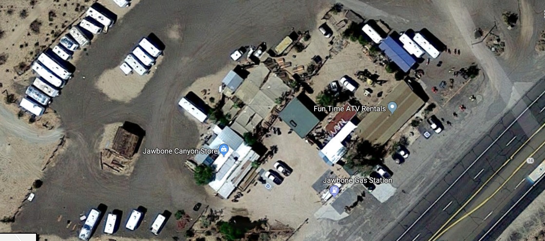
Left is the clean Friends of Jawbone Station. Right is the messy
looking Jawbone Canyon Store zone. Just saying . . .
The Jawbone Canyon store is a privately run operation where you can
get rent a ATV, gasoline, oil, junk food snacks. Also looks like some RV
parking in the back.

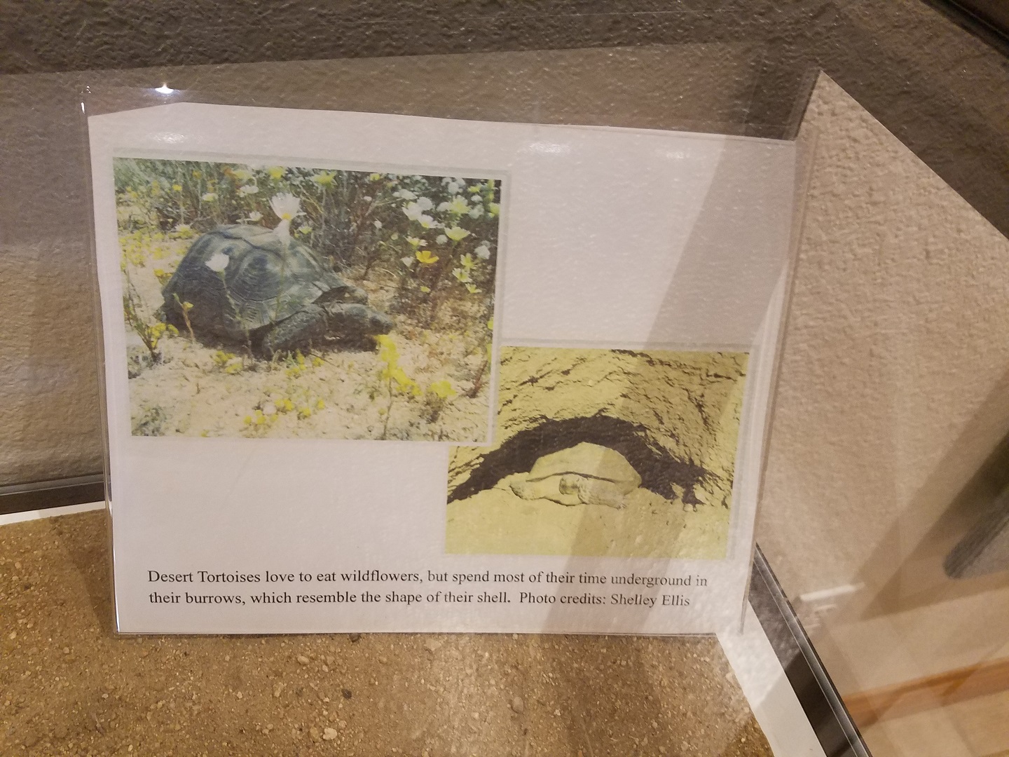
Their are 2 main types of desert tortoise:
1. Sonoran desert
tortoise
The Sonoran desert tortoise is flat and pear-shaped. The
Sonoran desert tortoise is more active in summer.
2. Western
Mojave tortoise
The Western Mojave tortoise which is more of a
butterball shape; they are usually active in spring.
These desert tortoises are herbivores that can grow to a length of 9
to 15 inches in (top) shell length. The desert tortoise will normally
live in underground burrows to help it escape temperatures that can
exceed 140 degrees F. The desert tortoise will spend at least 95% of its
life in these burrows. There, the tortoise is also protected from
freezing while in a dormant state from November through February or
March.
The availability of suitable digging soil for burrows is a
limiting factor to desert tortoise distribution. Some of their burrows
extend only just beyond the shell of the tortoise inside. And this fact
is another valid reason why the desert tortoise needs protection from
vehicular traffic as the burrows can easily be crushed by off road
vehicles. Other burrows may extend for several feet but the opening can
still be caved in by vehicular traffic. A single tortoise may have a
dozen or more burrows distributed over its home range. These burrows may
be used by different tortoises at different times.
Read more
about the desert tortoise in a full length article from DesertUSA by
clicking the Logo below.
STAGING AND CAMPING AREAS: The entire OHV area and surrounding
public lands are open to primitive camping. Within Jawbone Canyon, there
are a number of excellent primitive camping sites and OHV
staging/off-loading areas. Most of the sites within the OHV area are
accessible by 2-wheel drive vehicles with trailers.
TRAIL RIDING OUTSIDE THE OHV AREA: Outside of the OHV area and
within the Jawbone-Butterbredt Area of Critical Environmental Concern
(ACEC), motorized vehicle use is restricted to a specific designated
road and trail network.
All cross-country travel is prohibited in these
areas, and the designated routes are marked with brown trail markers.
You may only use the designated route network -- all other trails are
closed -- even if you do not see a red closed sign.
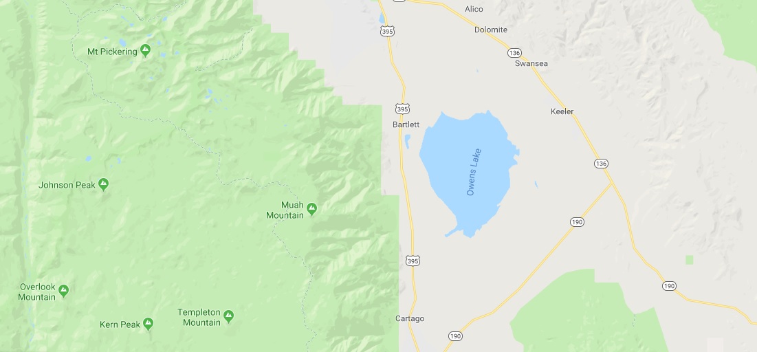
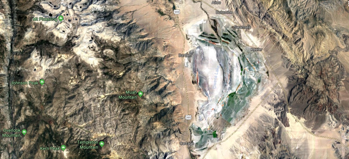
Owens Lake should be properly referred to as Owens Dry Lake Bed!
Google Maps, Yahoo! Maps MapQuest and Bing Maps all used to show
Owens Lake as a blue lake full of nice fresh water. Now Google maps is
one of the last to move to some form of reality.
But in reality it looks like this. The satellite image give some
stark reality to the current Owens Dry Lake Bed!
Don't let that puddle of water fool you. It is just dust mitigation
forced upon LADWP by a court injunction!
Just a few miles to
the north east of the Jawbone area we have the Red Rocks Canyon Park. A
study in June of 2007 reveals the how and why OHV's are such a threat to
the desert lands. Red Rocks Canyon is not any different from the Jawbone
Canyon area with both zones having significant and permanent damage to
the landscape. If you do not believe me then READ the entire report
below from the California State Parks.
Effects of Off-Highway Vehicles on Archaeological Sites in Red Rock
CanyonExcerpt from the above article:
A large volume
of published research exists concerning the effects of off-highway
vehicle use upon public lands, including, numerous studies in the
California deserts (e.g., Belnap 1995, 2002; Brattstrom and Bondello
1983; Bury and Luckenbach 1983; Eckert et al. 1976; Gilbertson 1983;
Havlick 2002; Hinckley et al. 1983; Kassar 2005; Lathrop 1983; Lovich
and Bainbridge 1999:315-322; Lyneis et al. 1980; Shore 2001; Sowl and
Poetter 2004; Webb and Wilshire 1983; Wilshire 1977, 1983; and others).
Scientific research on OHV effects initially grew out of a response by
federal and state land-managing agencies to the exploding growth of
vehicle recreation in the late 1960s and through the 1970s. According to
this research, off-highway vehicles damage soils directly through (1)
disruption of the surface soil and (2) compaction of the surface soil
and subsoil (e.g., Belnap 1995, 2002; Dregne 1983:26; Webb et al.
1978:228-232). The most important long term effect of OHV use on public
lands is the accelerated erosion and the attendant inability to support
natural revegetation (Webb et al. 1978:219).
Dr. Howard Wilshire (1977,
1983), then a geologist with the US Geological Survey, states that none
of the natural soil stabilizers inherent to California deserts can hold
up to the damaging effects of repeated vehicle passes. Even a single
pass by an OHV or any vehicle upon desert soils can be sufficient to
effectively destroy soil components (Wilshire 1977:ii). Tuttle Ridge, a
landform found in Red Rock Canyon SP, is a prime example of
extraordinary soil and plant loss from OHV use (see the observations in
Wilshire 1977:6-8). Soil and sediment loss in the areas disturbed by
vehicles was determined to be 11 million kg of material (Wilshire and
Nakata 1977). Ongoing gully erosion and highly visible scarring on
Tuttle Ridge over 25 years after its closure to vehicle use are
manifestations of past unregulated OHV recreation (Figure 2, pictured
below).
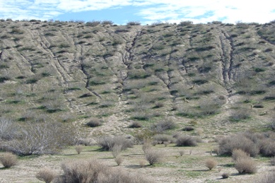
Figure 2. Tuttle Ridge is a prime example of soil and plant loss
from OHV use.
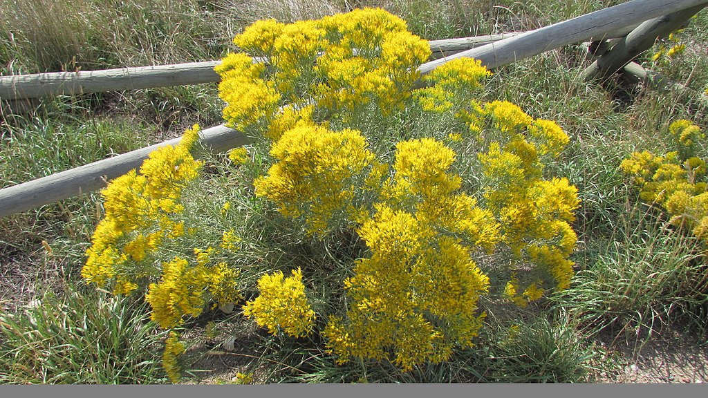
Rabbitbrush (Wikipedia)
rabbit bush - pleasantly aromatic shrub
having erect slender flexible hairy branches and dense clusters of small
yellow flowers covering vast areas of western alkali plains and
affording a retreat for jackrabbits; source of a yellow dye used by the
Navajo. Chrysothamnus nauseosus, rabbit brush.
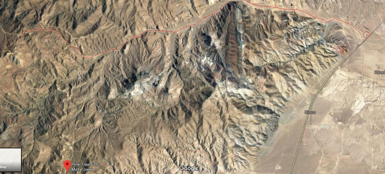
Here
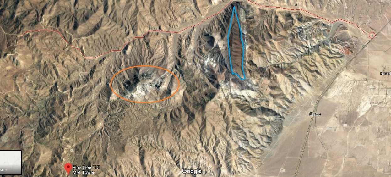
is the route taken through Jawbone Canyon up to the guard shack.
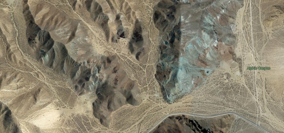
In the above satellite image you will also notice a couple of
geological anomalies. I have circled one in orange and the other is a
polygon area outlined in turquoise.
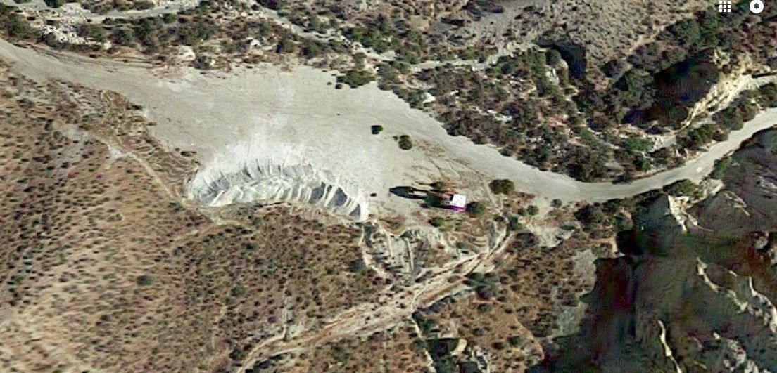
The area in orange is
interesting in that from a satellite view the white area almost looks
like snow! And yes at time during a wetter and colder winter this area
can be covered in snow. But his is NOT snow. But chalk or more likely
gypsum.
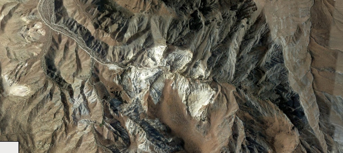
Lets take a closer look.
You can see a well defined dirt road leading south from the
Jawbone Canyon road to this area.
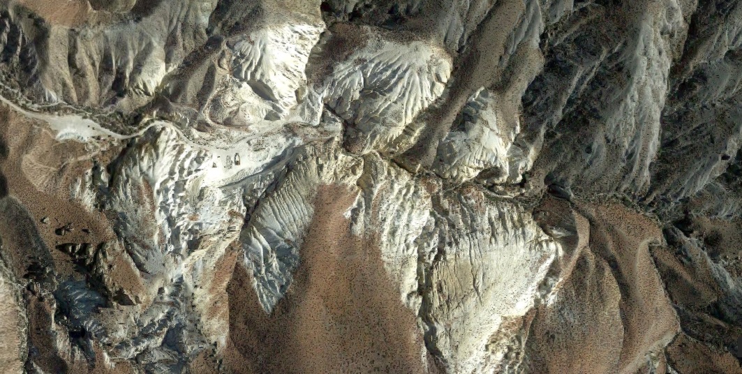
Now for a close up image of this area . It's a mining operation! Or
better stated a surface mine of either chalk or gypsum as stated
earlier.
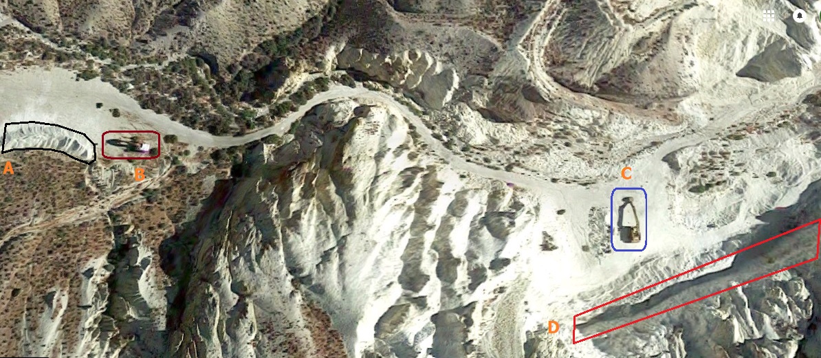
In the below image we have 4 areas I found interesting:
- A- mound of gypsum, ready for loading and shipment.
- B-Backhoe used for loading the gypsum into center dump
trailers or dump trucks.
- C-Unknown peice of mining equipment.
- D- Mine face or wall where the gypsum is actually being
removed from the mountain.
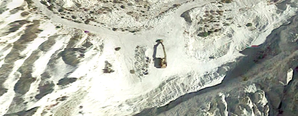
Here you can see the mound of gypsum and the backhoe loader
clearly.
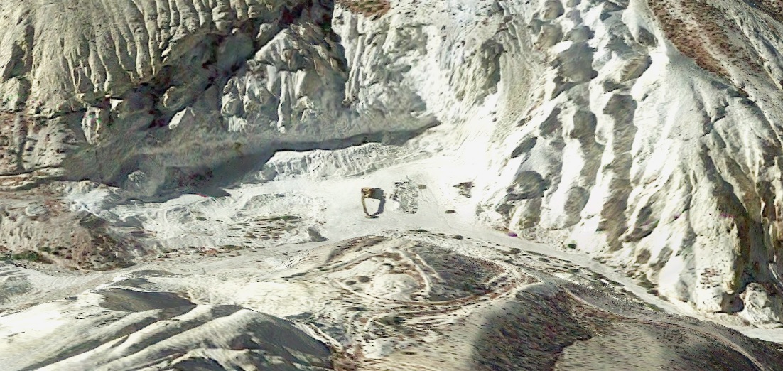
Closer view of the unknown piece of mining equipment and the
mine pit area.
Below is a 3D view of the mine operation but with the view
turned 180°. I am very curious as to what type of machinery this is?
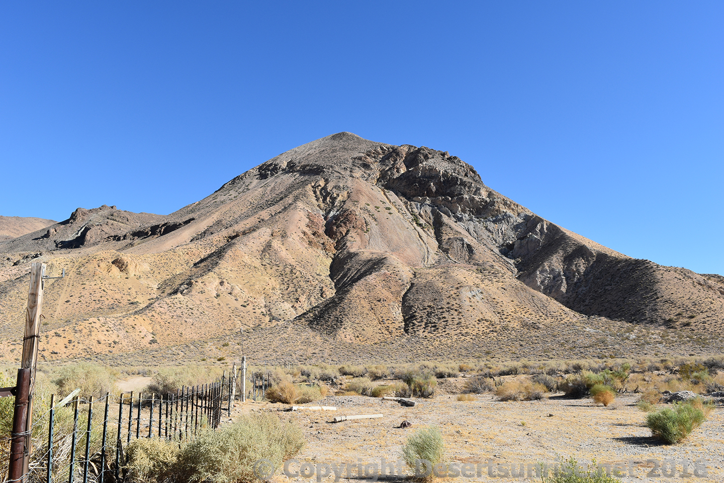
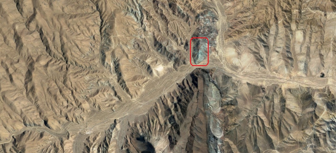
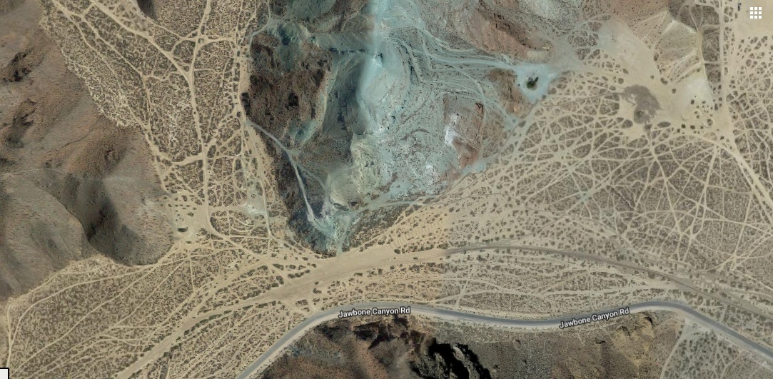
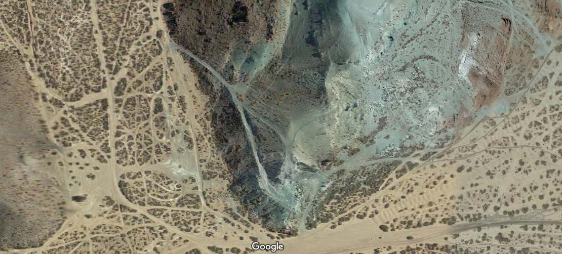
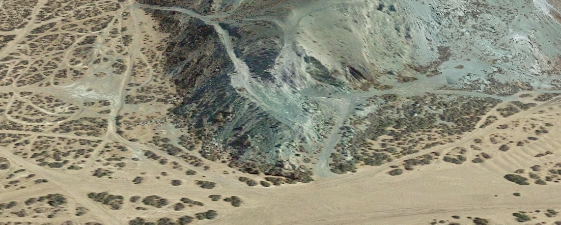
Another feature that can be seen when traveling up the Jawbone
Canyon Road just as you turn the corner in the area marked in turquoise
above.
Above is the area of interest marked in
Red. It is another geological feature seen often in the Western
Desert zones.
Above we can see something else clearly other than the large amount
of
Blue-green rock. ATV trails
everywhere!
This
Blue-green
rock outcrop is considered sacred by the native Americans who once
inhabited this area.
Below we can get a better look at this hill of
Blue-green rock. And what is this blue-green rock
anyway?
Chrysocolla is the scientific name. And this rock can be
found in many locations throughout the desert southwest. It is usually
found this Blue/Green form thay is known as Chrysocolla. It is NOT
Turquoise!
Chrysocolla can be mined if large enough amount of
copper can be found in the ore sample. It's the copper mineral that
gives the rock it's blue-green coloring. It's the mineral oxidizing with
air, just like old copper and brass fixtures.
If you look closely
in the last photo above you can see that a open pit mine operation or a
gravel pit was once tried here.