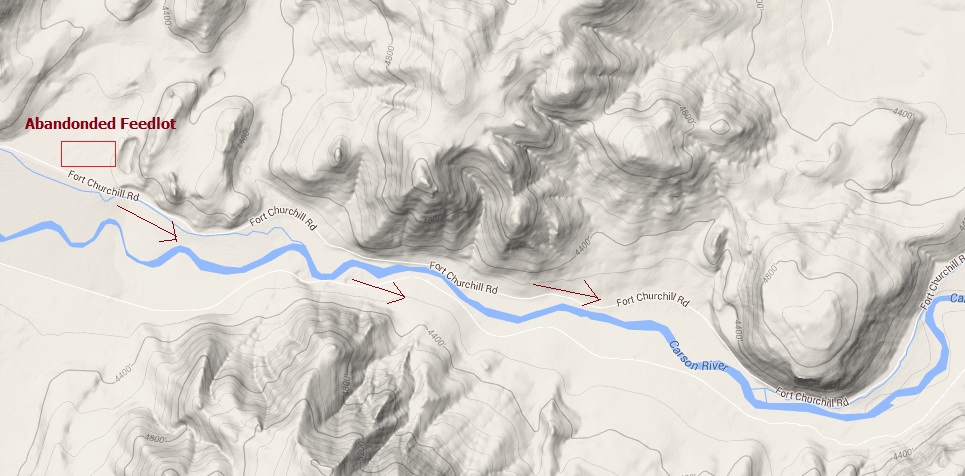
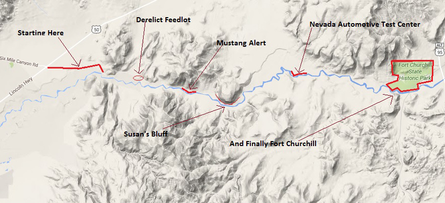
After leaving the abandoned cattle feedlot and heading down the Fort
Churchill road (actually heading East) I began to notice a rather large
rocky outcropping looming in the distance. As I drove closer I knew
something interesting was in store for me.
Actually 2 sets of large rocky type outcroppings were ahead of me. Here for
a short distance the Carson River Valley narrows quite significantly.
The valley began to open a little wider on both sides of the road the
further east I went, but I could see that within a mile or 2 the road would
narrow again right at the large rocky outcropping or bluff.
Sparse vegetation on these Nevada hills that are in the shadow of the High
Sierra's and thus receive scant rainfall.
Spring is short here and any annual grasses dry out fast after the harsh but
low precipitation winter.
Here is the first close up view of the outcropping called Susan's Bluff! For
sure I am going to find out more information as to how and why this rocky
mount received it's name.
There are as I count 3 different versions of how this bluff came to be known
as "Susan's Bluff". All the stories will agree that it was a pioneer woman
(about age 15) who was traveling with her family along the Emigrant Trail
and her death that ultimately lead to the location being called Susan's
Bluff.
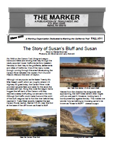
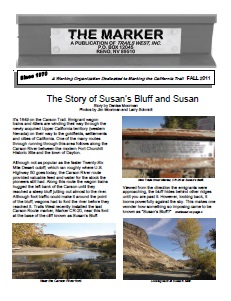
I have found a excellent source for all 3 versions of the story. So instead
of me re-telling the story and confusing all the readers, I will let this
excellent web site do it correctly. It is from the folks at Trails West.
(http://emigranttrailswest.org).
The actual story can be found on this link:
http://emigranttrailswest.org/wp-content/uploads/2010/09/The-Marker-Fall-2011.pdf.
But below I have provided a short version from the same PDF. But do head on
over to their website as they have plenty of interesting stories, history
and a few photo logs of the emigrant trails with photos of the marker
locations.
Here is one that concerns our story It follows the emigrant
trail(s) from the Humboldt Sink up to the Sierra Mountains.
http://emigranttrailswest.org/virtual-tour/carson-trail/.
By the way, Trails West, Inc. was founded in 1970. It is a non-profit
organization of emigrant trail enthusiasts who research, locate and mark
emigrant trails, and then publish guides to interpret them.
So now that we know how the bluff received it's name, let us look at the
basalt bluff from a different angle.
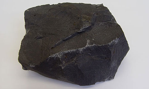
And just what is this basalt stuff? So glad you asked!
Basalt is a dark-colored, fine-grained, igneous rock composed mainly of
plagioclase and pyroxene minerals. It most commonly forms as an
extrusive rock, such as a lava flow, but can also form in small
intrusive bodies, such as an igneous dike or a thin sill. It has a
composition similar to gabbro.
Uses of Basalt. Basalt is used for a wide variety of purposes. It is
most commonly crushed for use as an aggregate in construction projects.
Crushed basalt is used for road base, concrete aggregate, asphalt
pavement aggregate, railroad ballast, filter stone in drain fields and
may other purposes.
Yes, there will be a quiz on this subject at the end of the road! So here is
to you Mr. Basalt, so often forgotten, easily misunderstood, always ignored,
run over by vehicles in the billions and crushed by massive machinery! You
have withstood the test of time and came out of all of this misfortune still
standing just like a black chunk of hard rock.
Now that we understand and are completely supportive of Mr. Basalt, let's
look further into this matter and examine one of his girlfriends, Susan
Bluff.
She is not so imposing from a distance but once you arrive closer you can
see that indeed she is quite large and chock full of basalt! The top of her
head is about 4800 feet above sea level and about 4,175 feet x 5,055 feet in width. Yep, she
is a big girl and no I do not know how much she weighs and I am not gonna
ask!
Now that you have read the story, you can just imagine the rough trek these
pioneers had to make getting to California.
I wonder what made this
particular group take the Carson River cutoff of the Carson Trail. And what
year was this all to have taken place?
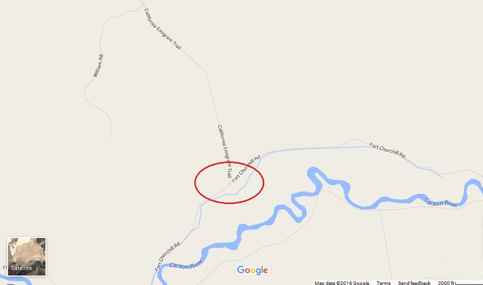
Below you can see that
for about 1 mile the Carson River flows close to the bluff, and that is
another reason why the wagon trains on the emigrant trail had to cross the
Carson River more than once.
The next point of interest on the Fort Churchill road I missed. Saw the
sign, but could not get any
photos of the trail marker or the trail as I was running out of time again, dang it!!
Part of the California Emigrant Trail comes (Carson River cutoff of the
Carson Trail) through here. Just a mile past the Big Susan's Bluff is where
the trail intersects with the Fort Churchill road.
It is nothing more than a dirt road but I am sure that trail had many
interesting points to view.
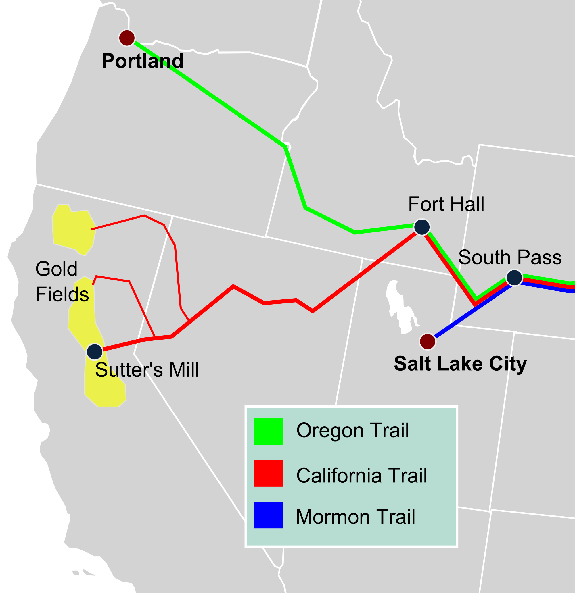
Below left is a overview map of the western portion of the Emigrant Trail.
All of these trail networks have become embedded in the folklore of the
United States. The Hollywood entertainment industry has used this era
(mostly incorrectly!) as a vehicle for a huge number of films. The
California Trail was one of the those significant influences that have
shaped the perception and character of the nation.
The remains of many wagon wheel ruts can be observed throughout scattered
locations in the arid portions of the American West.
OK. Once again a mini history lesson follows. But not to worry their will be
NO quiz at the end of the road! The text is from Wikipedia so beware.
In the American Old West, trails were used by immigrants from the
eastern United States, between 1830 and 1870. These colonists began to
settle various regions of North America west of the Interior Plains,
during the overland migrations of the mid-19th century. Settlers
following these 'Westward ways' were spurred by various motives, among
them including persecuted Mormons seeking freedom of religion. After the
end of the Mexican-American War in 1849, there were many new enticing
American conquests. Legislation like the Donation Land Claim Act and
critical events like the California Gold Rush further incited colonists
to travel overland west.
There were two major wagon networks, one based typically out of Missouri
and the other out of Santa Fe de Nuevo México. Three of the
Missouri-based routes were collectively known as the Emigrant Trails,
the Oregon, Mormon, and California Trails. Historians have estimated at
least 500,000 emigrants used these three trails from 1843–1869, and
despite growing competition from transcontinental railroads, some use
continued into the early twentieth-century.
Three of the major southern routes were the Santa Fe Trail, the Southern
Emigrant Trail, and the Old Spanish Trail and its wagon road successor
the Mormon Road, a Southern Route of the California Trail used in the
winter that used the western half of the Old Spanish pack horse trail.
The trip was arduous, fraught with risks from infectious diseases,
dehydration, injury, malnutrition, and harsh weather, with up to
one-tenth dying along the way, usually due to disease.
The next stop on the Fort Churchill is completely and totally unexpected.
The event that follows is 100% accurate but names have been changed to
protect the innocent and the . . .
See for yourself! Next stop NATC of the Twilight Zone.
Go directly by clicking
Here or
use the Image Map below.