|
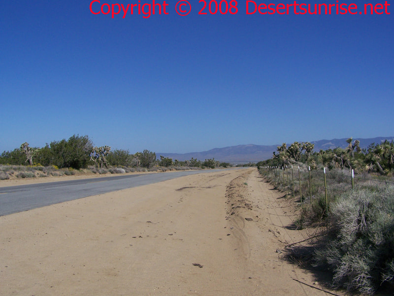
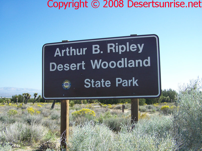
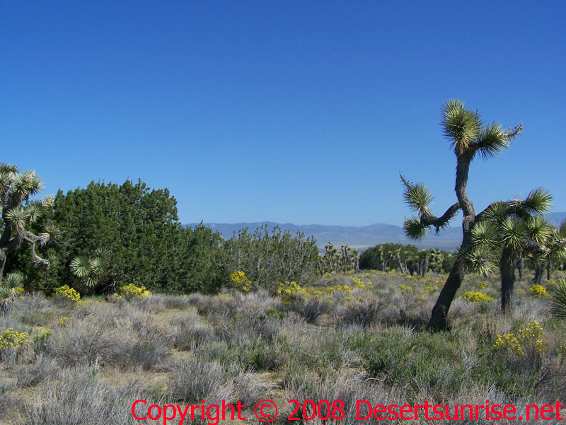
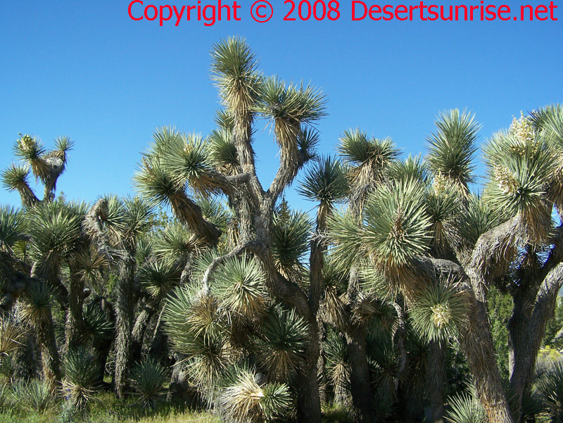
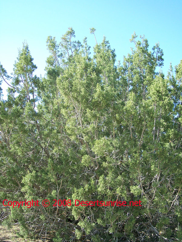
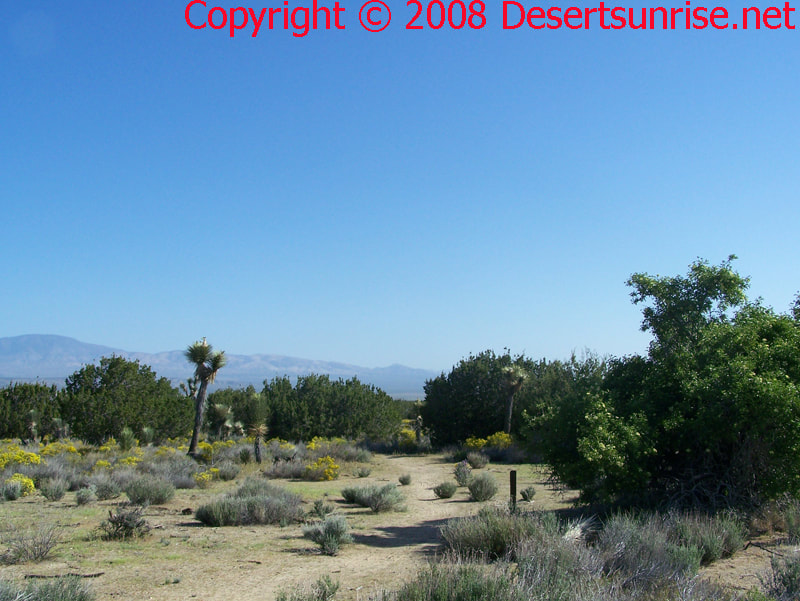
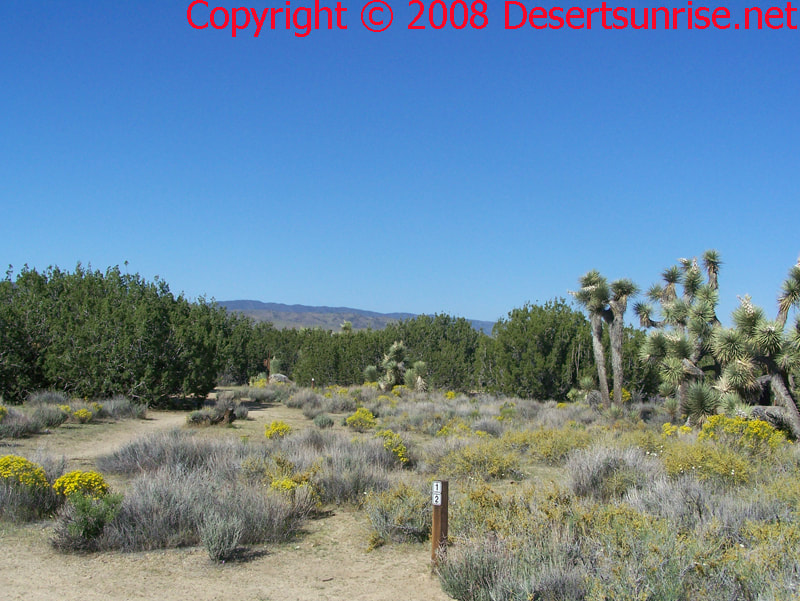
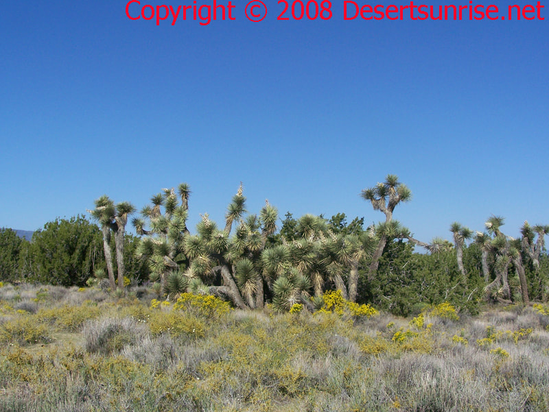
Welcome to the Ripley Desert Woodland State Park photo gallery brought to you by Desertsunrise.net The Ripley Desert Woodland State Park occupies 560 acres in the Western part of the Antelope Valley. Here you will see one of the few remaining examples of a virgin forest of Joshua and Juniper Trees. Except for some alien grasses and the lack of native bunch grasses, this is probably how many parts of the western Mojave Desert must have appeared to early white (European) explorers, settlers, miners and ranchers as they came through or settled in the Western Antelope Valley. Explorers such as Pedro Fages (1772), Spanish Franciscan friar Francisco Garces (1776), or John C. Fremont (1848) had without a doubt an amazing view of the of the Western Mojave Desert that we will never see. In the years before the large migration of settlers, farmers, and ranchers many parts of the Mojave Desert had desert woodland forests. Just try and imagine that what we see here in a few photographs of a desert woodland spread out in vast forest covering a large part of the desert! "Joshua trees and Junipers are the dominate species of plants with a large undergrowth of California buckwheat, golden bush, Mormon tea, blue sage and beavertail cactus. In the spring following a wet winter, many species of annual wildflowers bloom throughout the Park". "The park is named for Arthur Ripley (1901-1988) who willed the property to the State. As a farmer, he cleared and farmed a large amount of acreage in the western part of the Antelope Valley but he also was concerned enough about the Joshua/Juniper woodlands to leave this area in a pristine state". Quoted from the Ripley State Park - Trail Guide Brochure Notice: The park brochure mentions a parking lot, but I never did find one! I parked on the side of the road. Beware - the sandy conditions on the roadsides in many desert area's can at times be very soft and your vehicle can easily become stuck. Here the soil conditions were soft but drivable. Fauna and Flora Watch out for slow moving tractors and trucks! A. Backpacking is not needed as the park is small. B. In the Summer & Fall bring large amounts of water. C. Either bring maps or review maps first. Cell reception is spotty. D. Unless posted, NO campfires or Stupid tobacco smoking! E. Free admission :) F. Leave No Trace This photo is a continuation of the previous but centered on the large stand of Joshua Trees. A possible reason for this clumping together is given in the brochure: "These could have germinated from seed but probably are sprouts from the underground rhizomes of a larger tree. In this manner, the mother tree clones itself. Although Joshua seeds germinate fairly easily, most of the seeds are eaten by birds and small animals and the larva of the yucca moth which pollinates the blossom".
0 Comments
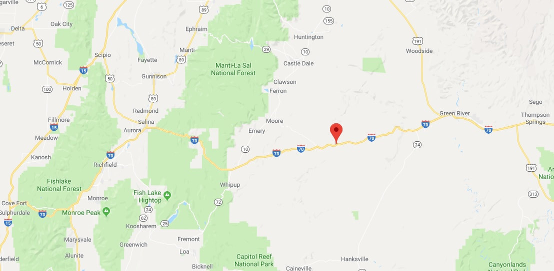
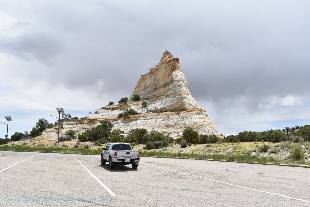
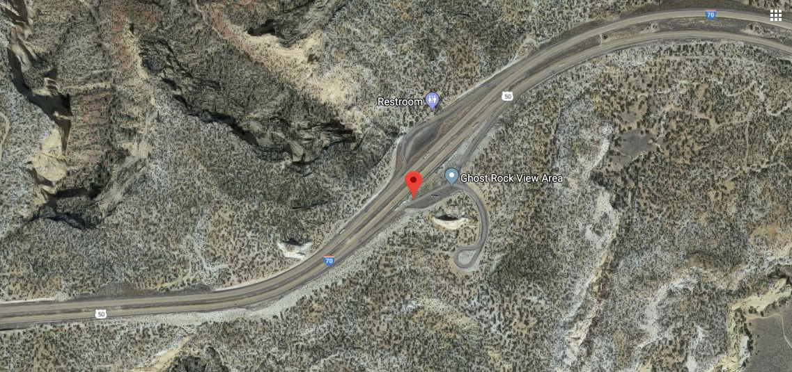
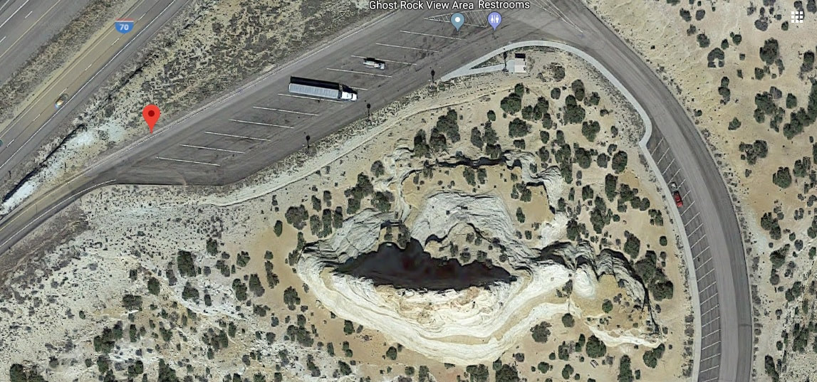
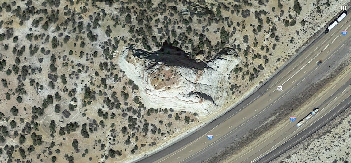
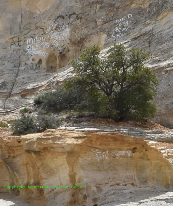
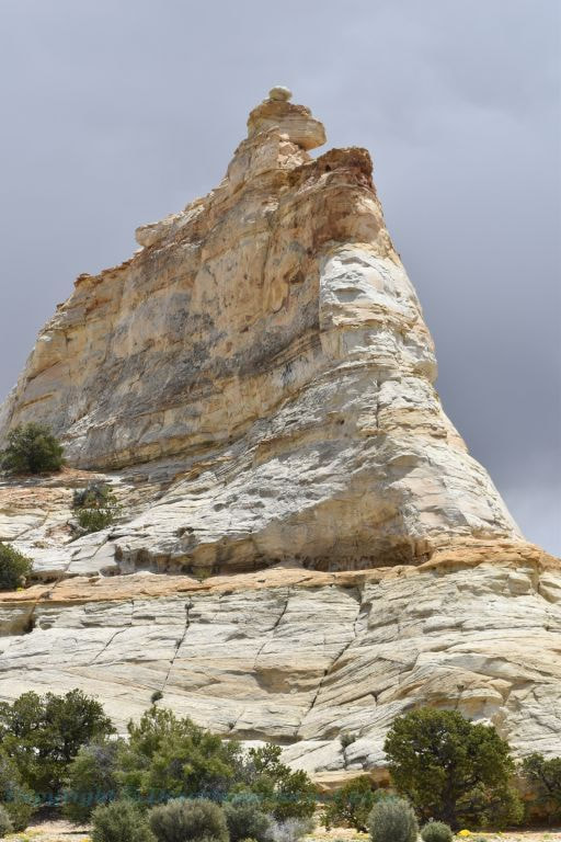
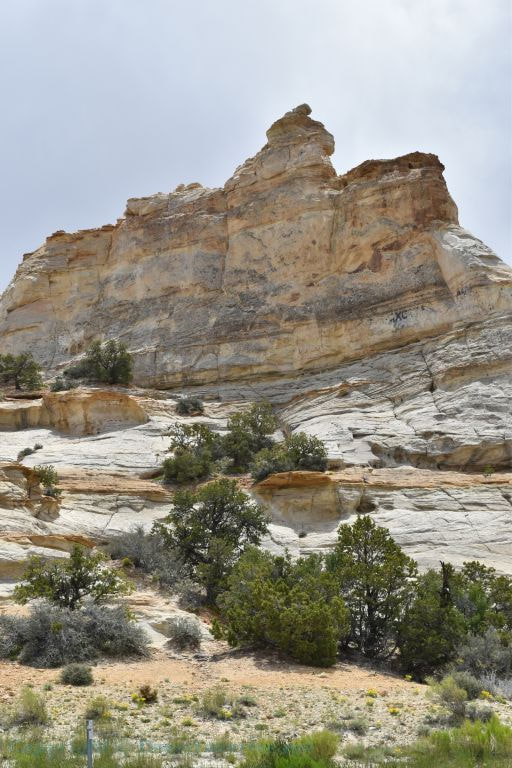
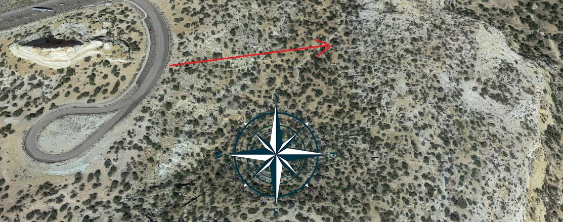
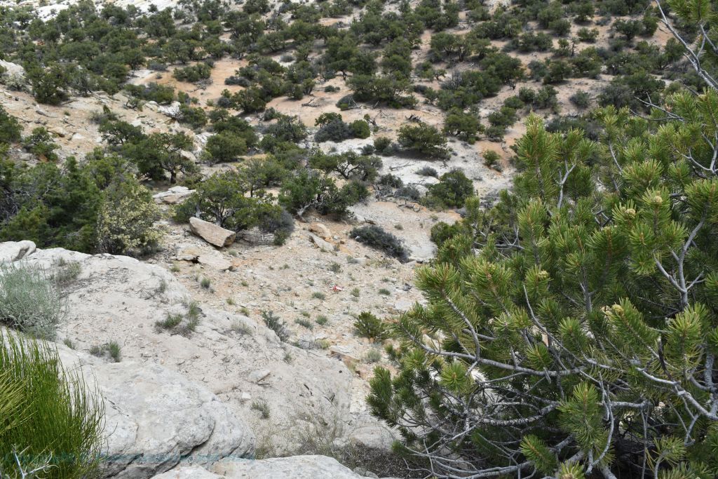
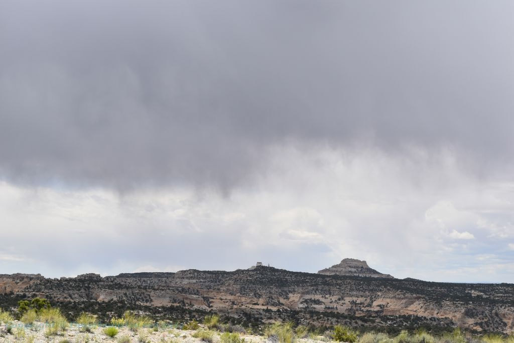
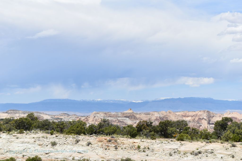
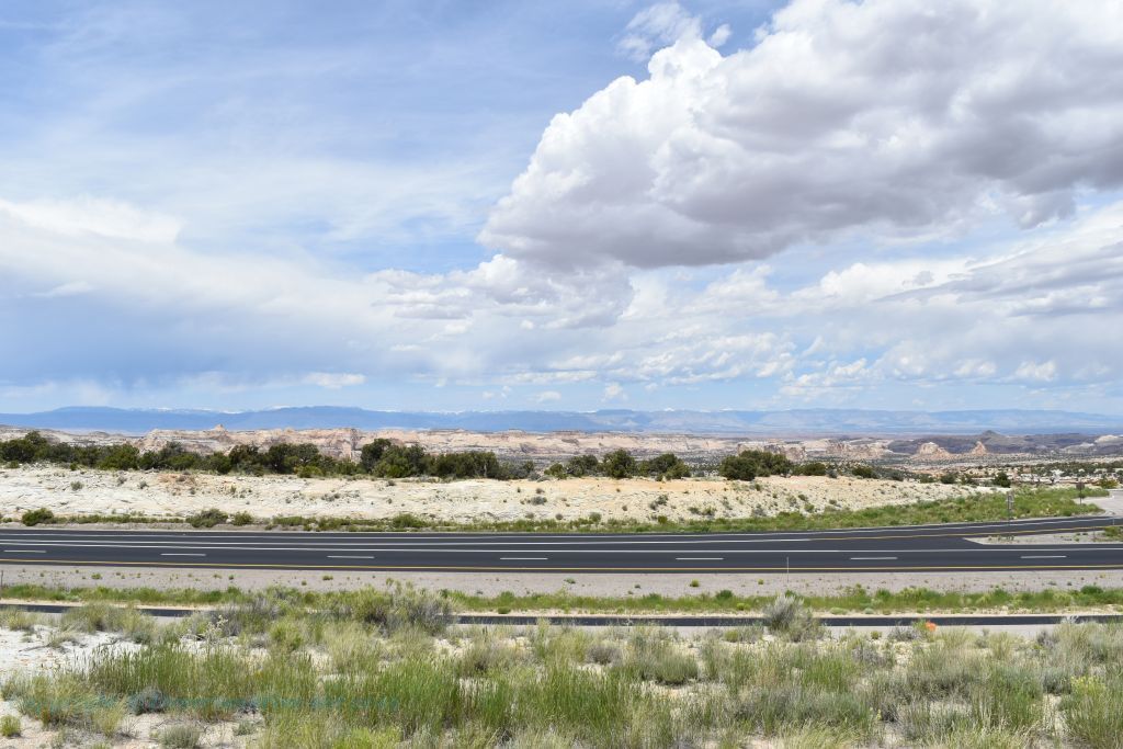
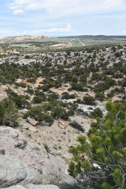
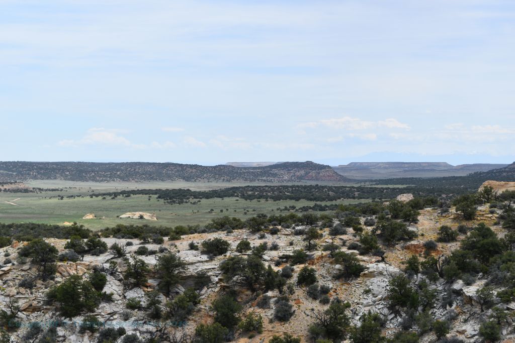
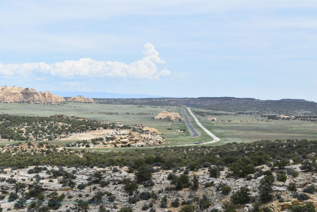
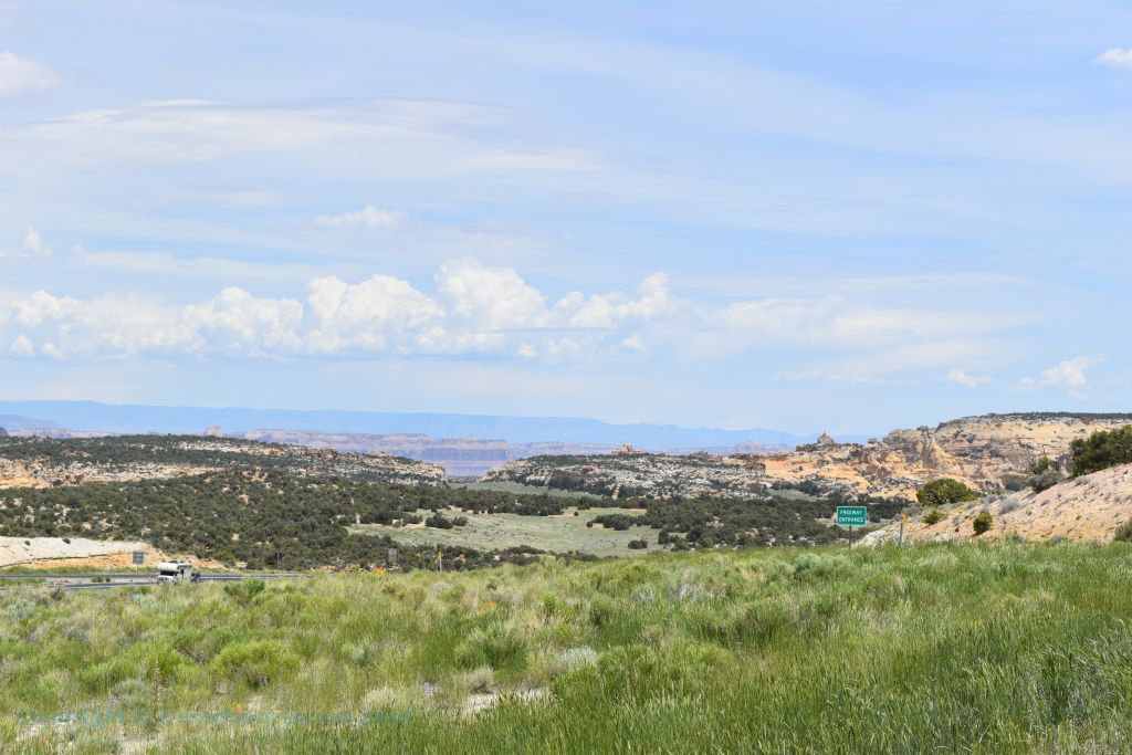
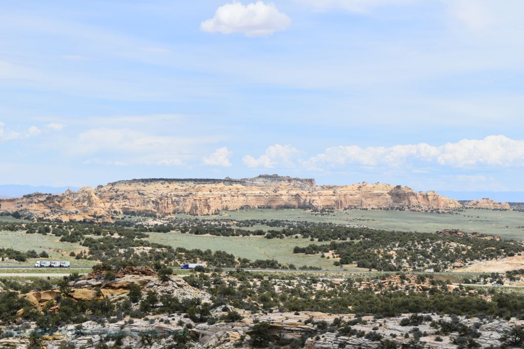
Ghost Rocks UtahIconic Rocks Jutting Out of the San Rafael Swell Traveling either east or west on the Interstate 70 between Salina and Green River in central Utah you will come across a couple of pinnacles jutting out of the high plateau of the San Rafael Swell. Before traveling this route you might want to get a road guide like this: Your browser does not support viewing this document. Click here to download the document. It's the San Rafael Swell that is responsible for creating the Ghost Rocks and the I-70 freeway cuts right through the swell from near the Freemont Junction almost to Green River. The I-70 ascends Ghost Rock Summit, which is the highest point of the I-70 freeway inside the San Rafael Swell and also where we find the Ghost Rocks themselves. At the summit is there truck rest area and a viewing area overlooking the Little Grand Canyon of the San Rafael River. The Ghost Rock Summit is named for the 2 unusual Ghost Rock formations nearby. Called the "Ghost Rocks" as there are actually 2 separated pinnacles one being Ghost Rock West and the other naturally Ghost Rock East. The naming of these 2 pinnacle features is buried within folklore. Most stories relate to a cowboys looking for cattle who came across these features then paused for a minute as the early-morning fog shrouded the base of the peaks so that all the cowboys could see were the pinnacles protruding above the fog base, which made the cowboys think of ghost-like figures floating in the air. But also note that the rocks are primarily white in color just like Casper the Ghost. Not that I am saying that the average cowboy of the late 1800's read comic books about a "friendly ghost" but the term "ghostly white" makes one wonder if that might be a more relevant term. Anyhow these rocky pinnacles were viewable for many decades only to a few locals as this area of central Utah was extremely remote up until the construction of Interstate freeway system. The Utah portion of the Interstate 70 was not completed until 1970 making the I-70 one of the last major segments of the Interstate freeway system to be completed. The Colorado portion of the I-70 is the very last portion of the Interstate system. This is through Glenwood Canyon and that segment was not completed until October 14, 1992. When the plans for I-70 were finally made, the route of the freeway would be right across the San Rafael Swell. At that time (late 1960's) the area west of Green River was still so remote that the survey crews had to use 4 x 4 jeeps to survey parts of the route and in the process came across herds of wild Mustangs. You know the 4-legged wild horse variety. To get a better idea of how remote the area was in the late 60's/early 70's a story has come out that during the highway's dedication ceremony (as told by an engineer who surveyed the highway), that when a group of engineers was approached by a sheep rancher and he asked what they were doing. The rancher then had a ROFL moment when it was explained that they were building a freeway. What the sheep rancher did not understand was that this freeway would change the local people’s way of life mostly for the worse. So, in 2002, the mayor of Richfield, Utah was interviewed by the Salt Lake Tribune newspaper about what changes they had I-70 brought to the Sevier Valley. Previous to the completion of the I-70 these were isolated farming/ranching communities, whose residents were unaccustomed to the crime and other detrimental effects that a transcontinental highway can bring. The residents of Richfield, Utah soon started to refer to the I-70 as the "Cocaine Lane". In the interview the mayor of Richfield stated that the I-70 is a mixed blessing. He stated that the Interstate 70 is a boon to the hospitality industry and has made Richfield more accessible to other cities within and outside of Utah. However, the new Interstate 70 has brought types of crime previously not known to our city. A major change in the rural lifestyle of this central Utah area came about after the completion of I-70, when many residents started to lock their doors for the first time. An interview with mayor of Richfield resulted from an event that served as a horrible "wake-up call" for the residents of peaceful rural Utah in that they were "no longer isolated from crime". In Richfield a panic soon ensued after the citizens witnessed Utah Highway Patrol troopers arresting a suspect and removing him in handcuffs, then removing plastic bags and ice chests full of body parts from the trunk of his car. The body parts were of a woman, later a dead male was also found hidden in the trunk, he was still intact. This event caused a mini frenzy of people checking on their neighbors to be sure that their neighbors were not one of the victims. Metro crime (Las Vegas, Los Angeles, San Francisco and so on) now can easily move along the interstate freeway freely into the small towns and villages of rural Utah. Even the Ghost Rocks are not free from this metropolitan urban filth. The Ghost Rocks now have that urban graffiti signature of stupidity! Both of the Ghost Rock formations stand out from the remainder of the mountains and mesas nearby. The Ghost Rocks themselves are listed as being at 7,420 feet (2,262 m) at the top of the rocks (Ghost Rock West). For Ghost Rock East from the rest area parking lot my GPS registered 2066 meters (6,772 feet) elevation while at the top of the rest area just under the base of Ghost Rock East my GPS registered 2221 meters (7,287 feet). That makes Ghost Rock East around 230 feet tall from the base but due to the rocks shape and color it stands out well among all the other peaks in the immediate area. I guess that climbing the rocks is allowed as I did not see any signs stating that climbing was prohibited. I am completely against this lame naive idea as both of the rock formations are too easily accessible to a vast amount of motoring human traffic due to the I-70's 2 rest stops on either side of the freeway. A constant flow of human climbers will cause undue damage to the rock formations. The material that makes up most of the Ghost Rocks formations is Navajo Sandstone. And before some fellow yells at me that all Navajo Sandstone is reddish, read below. Direct from Wikipedia: The wide range of colors exhibited by the Navajo Sandstone reflect a long history of alteration by groundwater and other subsurface fluids over the last 190 million years. The different colors, except for white, are caused by the presence of varying mixtures and amounts of hematite, goethite, and limonite filling the pore space within the quartz sand comprising the Navajo Sandstone. The iron in these strata originally arrived via the erosion of iron-bearing silicate minerals. Initially, this iron accumulated as iron-oxide coatings, which formed slowly after the sand had been deposited. Later, after having been deeply buried, reducing fluids composed of water and hydrocarbons flowed through the thick red sand which once comprised the Navajo Sandstone. The dissolution of the iron coatings by the reducing fluids bleached large volumes of the Navajo Sandstone a brilliant white. So why is rock climbing on these 2 features such a stupid idea? Think about this; the Interstate freeway (I-70) brings tens of thousands of visitors weekly by these 2 pinnacles and if even only a few out of these thousands of visitors actually climb the rocks you still can have up a possible 100,000 climbers shredding these 2 peaks. Sandstone is not a hard rock. Read the quote below from www.canyoneeringusa.com: "Sandstone is held together by impurities such as clay and lime that are deposited with the sand. Navajo sandstone lacks these impurities and thus is poorly held together. The rock is weak and often crumbly, but still forms huge cliffs. The rock near the top is especially pure, white and weak, partly because it was deposited as pure sand, and partly because rainwater, over tens of thousands of years, has dissolved what little binding material was available and carried it down through the rock to the lower layers". When visiting this road side stop in the middle of June rain showers were popping up all around the San Rafael Swell even though the temperature was hovering around 96°. The higher altitude of the San Rafael Swell at around 7,000 feet in elevation makes this area a zone of high plant endemism, with many native plants being endemic to the swell and not occurring anywhere else in the world. The San Rafael Swell is a beautiful place to hike, picnic and shoot photos but everyone should be reminded to beware of the Biological Soil Crust! The San Rafael Swell is part of the Colorado Plateau and is full of this clumpy, blackened soil. This soil is extremely important to the health of the high desert areas of Utah, Arizona and Colorado. Your browser does not support viewing this document. Click here to download the document. Direct from the National Park Service: Biological soil crust is just what the name describes – a living soil that creates a crust over the landscape. Biological soil crust is found throughout the world, from the Colorado Plateau’s high desert to the arctic! In many places, soil crust comprises over 70 percent of all living ground cover. The knobby, black crust here includes lichen, mosses, green algae, micro fungi, and bacteria, but is dominated by cyanobacteria. Biological soil crust has helped shape today's high desert. Soil crust helps control erosion by keeping soil stuck together in one continuous crust. Sediment doesn’t wash away in the rain or blow away in the wind. This is why the Colorado Plateau’s high desert isn’t covered in loose sandy dunes. Soil crust also holds and retains water. Plant roots tap into this spongy crust to survive dryer and hotter conditions. It also promotes plant life by taking nitrogen from the air and changing it to a kind of nitrogen plants need. Without these effects, animals, and even humans, would not be able to survive well in the desert. There is much more to see than just the two jutting rocks. You can walk or drive to the back side of Ghost Rock East to examine a view of the cliffs to the east. 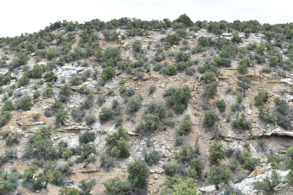 The satellite image above this photo shows the approximate location and direction of the photo directly above. It is interesting for 2 reasons. 1. You can see clearly the weathering of the hillside with the sandstone ridges breaking apart. Wind and especially rain have an adverse effect on sandstone. 2. Beyond the immediate hill to the east is an escarpment leading to a valley below. I saw a number of trails that can be easily hiked down through escarpment to the valley below. But alas a thunderstorm was brewing up directly over the Ghost Rocks area and I was dressed for 100° weather! No trail hiking this afternoon. Only time enough for a few more photographs and then back to the Interstate 70 east to Arches National Park. The view from the rest stop parking lot was just fine. The urge to climb just the bottom portion of Ghost Rock East to receive a better sweeping view was met by even a greater urge to preserve what little nature we have left in this nation. Bibliography
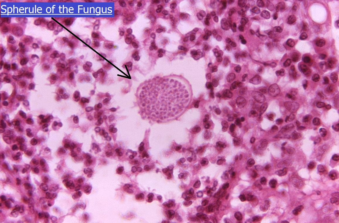
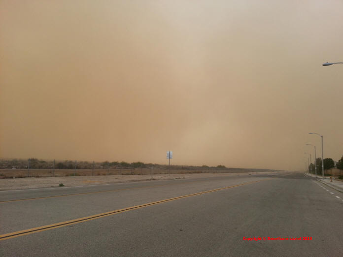
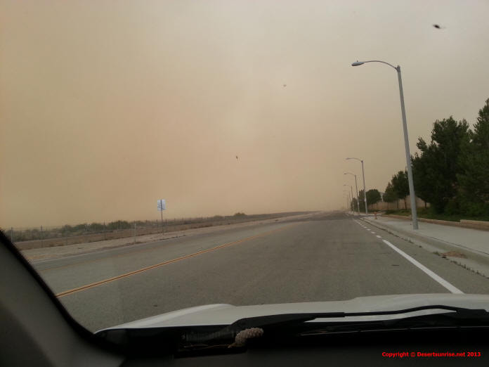
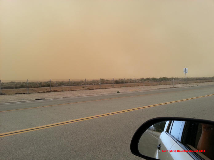
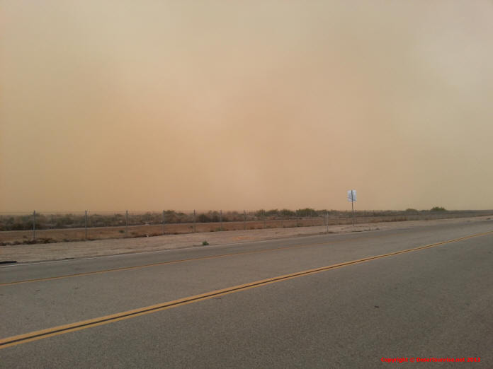
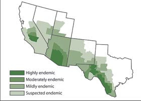
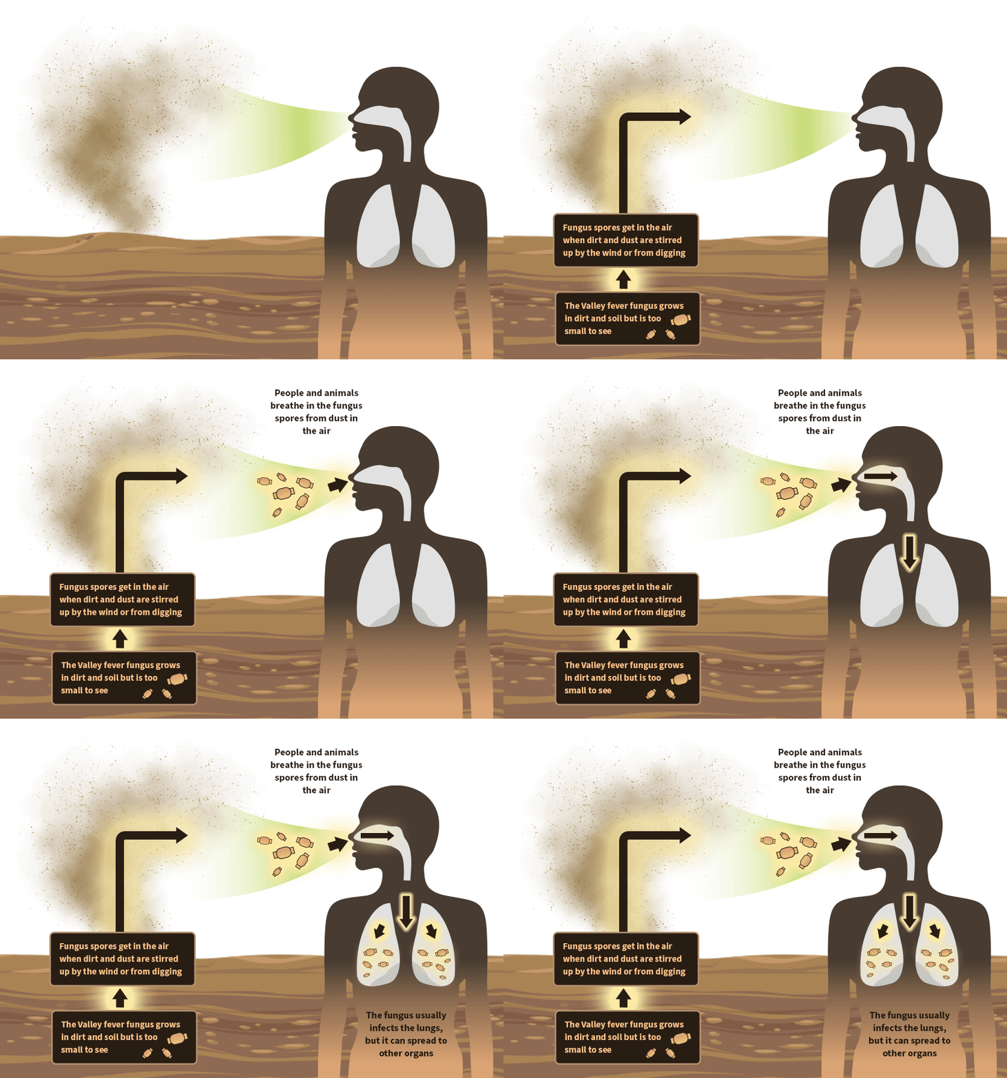
https://en.wikipedia.org/wiki/San_Rafael_Swell https://www.nationalgeographic.com/science/earth/the-dynamic-earth/weathering-erosion/ https://en.wikipedia.org/wiki/Interstate_70_in_Utah https://www.deseret.com/2002/3/16/19643600/driver-charged-with-murder https://eq.uen.org https://www.canyoneeringusa.com/zion/geology https://ugspub.nr.utah.gov/publications/geologicmaps/30x60quadrangles/m-242.pdf https://www.canyoneeringusa.com/zion/geology https://www.rockbreaker.com/equipment/breakers https://www.inaturalist.org/check_lists https://www.nps.gov/articles/seug-soil-crust.htm https://www.gomoab.com/moab_environment.html Valley FeverWhat is "Valley Fever" ? Definition By Mayo Clinic staff: "Valley fever is a fungal infection caused by coccidioides (kok-sid-e-OY-deze) organisms. It can cause fever, chest pain and coughing, among other signs and symptoms. Two species of coccidioides fungi cause valley fever. These fungi are commonly found in the soil in specific areas and can be stirred into the air by anything that disrupts the soil, such as farming, construction and wind. The fungi can then be breathed into the lungs and cause valley fever, also known as acute coccidioidomycosis (kok-sid-e-oy-doh-my-KOH-sis)". Mild cases of valley fever usually resolve on their own. In more severe cases, doctors prescribe antifungal medications that can treat the underlying infection. Antelope Valley Dust Storms CDC In a very small proportion of people who get valley fever, the infection can spread from the lungs to the rest of the body and cause more severe conditions, such as meningitis or even death. Valley fever cannot spread from person to person. Most cases of valley fever in the US occur in people who live in or have traveled to the southwestern United States, especially Arizona and California. The map below, “Areas where valley fever is endemic,” was generated from studies in the 1950s, and shows the areas where the fungus that causes valley fever is thought to be endemic, or native and common in the environment. The full extent of the current endemic areas is unknown and is a subject for further study. But also note that Valley Fever is spreading out from the desert areas of the Southwest into the plains states and even into the northern mountain states. What You Need to Know Cough?? Fever?? Exhausted?? Ask you doctor to test you for Valley Fever. It is difficult to avoid exposure to the fungus that causes valley fever, and there is no vaccine to prevent the infection. Therefore, if you have symptoms of valley fever and you live in or have visited an area where the fungus that causes the infection is common in the environment, ask your doctor to test you for valley fever. If you have valley fever, you may need treatment with prescription antifungal medication. Research is needed to find out the best treatment for valley fever. Other research is under way to develop a vaccine to prevent valley fever and to create better antifungal medications. Coccidioidomycosis was first discovered in the early 1890’s in Domingo Ezcurra, an Argentinean soldier. Some pathologists believed his skin conditions were the result of cancer. After tissue biopsies his illness was thought to resemble the protozoan coccidia, often found in chickens. To this day the name of coccidioidomycosis still represents this early misdiagnosis. The Ezcurra case was followed for eleven years and he ultimately died of his illness. By 1900 coccidioidomycosis was established as a fungal disease. After an outbreak in the 1930’s in the San Joaquin Valley of California, this disease was given its nickname “San Joaquin Valley Fever,” often shortened further to “Valley Fever.” The disease threatened national security during World War II when thousands of American soldiers became sickened while training in the Southwest. It even affects our military today -- as seen during a 2002 Navy Seal training exercise in California when 45% of the squad fell ill. There is still no cure for coccidioidomycosis and no vaccine, but we are working to change that. Be a voice for action! The Antelope Valley has seen some recent heavy construction of 2 large solar power plants in the West area north of the 138 Hwy (Ave. D). Also continued construction of homes is causing even more soil disturbance. But probably the largest cause of recent outbreaks of Valley Fever might be caused by the large number of farmlands that are now being abandoned due to loss of water rights and the general decline of farming in the USA as a whole. So remember when you see a dust storm like the one pictured above, take cover indoors, close windows, doors, garage doors and turn on the AC or swamp cooler if it is hot weather. Do this until the dust storm ends. Another Underlying Cause Another reason why so much desert soil disturbance is seen today along with the rise in Valley Fever compared to just 40 years ago is due to the massive Population Increase in many of the Western desert states. This has lead to huge housing complexes sprouting up in the desert like weeds after a heavy rain.
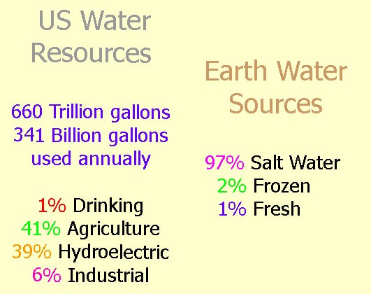
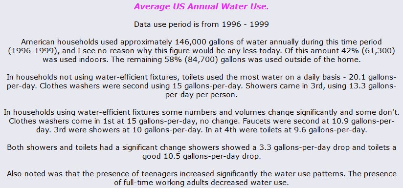
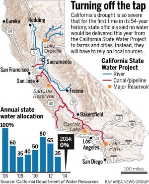
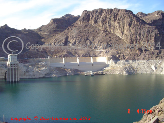
Yes, people want to own their own home. People want new safe neighborhoods (oxymoron statement, as new does not always get you "safe") and virtually the only available large flat land is in the desert. It is not just houses and strip malls that are causing the desert soil to be disturbed. All those new homes, skyscrapers in Los Angeles, Las Vegas, Phoenix need electricity! Yes more roads and more roads. At one time the West received a large portion of it's electricity from the river dams and a few nuclear power plants along with a few coal fired electric power plants such as the now defunct power-plant in Page, AZ (Navajo Generating Station). But now with a smaller snowfall in the mountains many of the power generating dams are scaling back production. And now California's only Nuclear power plant is being shut down. Where are all these massive new sprawling suburbia's going to get electricity for can openers, Air Conditioning units, 60 inch TV screens and PC's so we can read this fellows web pages? (The current Cali governor has actually halted plans to shut down Diablo Canyon power plant as it is now California's single largest electric power generation plant and da governor knows that with fickle wind power and solar power not working at night shutting down this last remaining nuclear power plant would leave Bay Area residents with multiple blackouts and brownouts) Solar and Wind to the rescue! Ha Ha Ha  Water or H2O = 2 atoms of Hydrogen and 1 atom of Oxygen and without that compound ALL life would cease to exist! In the Western United States, water, water rights, water use and abuse has been an issue of great concern from the days of the first European explorers right up until today. Most of the continental western states are arid except for the western portions of Washington - Oregon and the North West of California. In the arid desert areas of the West a new war is being fought, over water! Battle lines are been drawn, forces massed and troops trained. But so far this war has not seen the US Calvary destroy what is left of the Native American Tribes nor is it a war against an external aggressor. But rather it is a war "against excessive internal consumption". The principle characters in this conflict are lawyers, farmers, ranchers, water agencies, water consumers, land developers and the media. Due to the mass media's ability to control and manipulate most of the information available to the general public, except for the internet, the grave water shortage has not garnered much attention. The average consumer just wants to know if he/she turns on the tap will water flow! Unfortunately far too much of our news and information comes from a few small "politically correct sources". Again, except for the internet, scant information is made available to the public concerning the gross water waste most of us commit every day. Now the Western desert regions are blooming through out all 4 seasons, but we are not speaking of Sage and Mesquite but new housing developments, apartment buildings, strip malls, and storage centers. And to connect all of this together we have new roads with lots and lots of new vehicles on the roads and in our driveways, garages, drive through car washes etc. This type of suburban development is very typical of Southern California where the term "transportation" equates to automobiles and virtually nothing else. And in our new houses we all want all the same luxuries we enjoyed in Los Angeles, Seattle, Miami, St Louis, New York, Chicago, London, Bonn, Berlin, Tokyo, Manila, Bombay, Mexico City. But most of the East Coast and Southern emigrants and even the established residents have been fed a false idea of desert living thanks to a individual named William Mulholland (September 11, 1855 – July 22, 1935). Real estate agents, housing developers, banking institutions, and the construction industries have all kept the Mulholland lie alive! So with the increased population the desert area municipalities are drilling ever deeper and more water wells. And now the water quality is decreasing, the cost of water is rising and the ground is subsiding along with other environmental problems. And it seems as if the popular mass media has gone PC again buy supporting this belief that our desert lifestyles will be no different from the lush green landscapes of the well watered Eastern & Northern states. This political correctness of the mass media (television - newsprint - radio - periodicals) seems to have infected both sides of the political spectrum. Money talks! What is extremely important for all of us to understand is that at any moment a group such as the ACLU, Sierra Club or even PETA could possibly bring a lawsuit against the citizens and municipalities of the Antelope Valley (a booming northern suburb of Los Angeles) for say excessive ground water pumping. This could put the Antelope Valley area in a similar situation as say Las Vegas. This is because the Antelope Valley is already pumping too much water out of the ground table and it is negatively affecting the landscape and also water quality (The Water Quality has become so notorious that the wife of the Desert Sunrise webmaster forced him to purchase an expensive and unique water softening system). Ground subsidence is evident. Native plants and trees die without surface watering. Natural streams and ponds that might have been available for watering animals in the past are now permanently dry year round. Remember this valley received it's name due to Antelope herds that once roamed the valley. Just think of how much water we use daily. You probably do not realize how much water we use and how much we actually waste, I didn't. The following information should give you a better understanding of just how much water we use and waste on a yearly basis. These figures are NOT for a particular state or city but for the general US population as a whole. What the information shows is that really significant water savings can be made especially in the desert states of the West. The following information is from the American Water Works Association: What all those numbers add up to is that with each new house built in the Antelope Valley we must pump an additional 146,000 gallons of water, or try and buy water from the State Water Project (California Aqueduct). The problem is that the desert is usually not capable of supporting a large population with or without commerce and industry present. The population pressures of the USA as a whole and in this case particularly southern California are experiencing a suburban sprawl into the desert regions. The same habits, ideas and views of a non-native population only worsens the water problem along with pollution and a general misunderstanding of the fact that a desert is NOT a wasteland. But our stupidity can and will and is at present making our deserts into a wasteland. The average house in the Antelope Valley probably wastes 50% of the water that is used for landscaping. The next time you take a walk, bike ride or drive through the Antelope Valley cities take a visual note of how much water you see rushing down the gutters into our storm drains when residents are watering their lawns! Desert type landscaping should be the norm not the "artificial green heaven" that developers promote. Perceptions Must Change Our perception of the desert must change! Listen to this. While speaking with a few of the neighbors about some possible changes to a more desert like landscaping I was planning to make, the hackles immediately went up on most of those I spoke with. The neighbors did not relish the thought that a house on the block might not have anything less than "Tarzan's Jungle Green Landscaping". The unspoken thoughts were "property values will drop" "it will be an eyesore" and the killer "it will look like we are living in the desert"! You can stop laughing now. I can only look aghast at people who make such illiterate statements like "the desert is full of sagebrush and it's best to leave it in the desert". For the love of God people, WE are in a desert. It is these perceptions that are holding us back from changing our lifestyles to reflect the environment we live in. In the Antelope Valley of California we can see a desert area being transformed from a rural ranching & farming valley into a urban housing & commercial valley. Honestly there are probably not many methods available to stop the influx of people into this valley, but with education, training and with a community aware of it's responsibilities to it's surrounding environment, the impending disaster can possibly be avoided. But the new urban settlers to the desert must have a conscience rooted not in the blind urban apathy, but in visual rural awareness. What that means is that all of this valley's residents (old & new ) need to see this valley as it once was (visually through old photo's and drawings) and visually see the impact WE are having on the surrounding environment. The desert is not a dumping ground for used car parts, derelict vehicles, irrigation pipes, construction debris, nor is it a vast off-road vehicle playground! A tread lightly concept must permeate throughout the valley's residents not through a government $$$$ program but through the area's commercial concerns, churches, clubs and schools. Water is the life blood of this valley (Antelope Valley) as with so many other desert communities throughout the West. Problem This information below is provided by the US Geological Survey at http://ca.water.usgs.gov/projects00/ca532.html Antelope Valley is located in the western part of the Mojave Desert, about 50 mi northeast of Los Angeles, California. The valley is a triangular- shaped, topographically closed basin covering about 2,200 square miles. Ground water is an important component of water supply in Antelope Valley, comprising about 50 percent in years with normal precipitation and as much as 90 percent in dry years (Templin and others, 1995). Estimates of average annual ground- water recharge range from about 40,000-58,000 ac-ft. (Snyder, 1955; Bloyd, 1967; Durbin, 1978). Pumping in the valley, primarily for agricultural uses, peaked in the 1950's when production may have exceeded 400,000 ac-ft. annually (Snyder, 1955). Increased pumping costs from greater pumping lifts and increased electric power costs resulted in a decrease in agricultural pumping in the 1960's and 1970's. Increased urban growth in the 1980's resulted in an increase in the demand for water and an increase in ground-water use. Ground- water-level declines as a result of the long-term ground-water withdrawals have increased pumping lifts, reduced well efficiency, and caused land subsidence (Ikehara and Phillips, 1994). Projected urban growth and limits on the available local and imported surface water supply are likely to continue to increase the reliance on ground water. Projections of water supply and demand estimate that the current supply will fall short of the projected demand by the year 2000 (Kennedy/Jenks, 1995). A deliberate management effort will be required to meet future water demand in the Antelope Valley without incurring significant economic and environmental costs associated with overuse of the ground-water resource. Conjunctive use of surface and ground-water will likely become an important part of water resource management in Antelope Valley. The ground-water system is the least understood component of Antelope Valley water resources. To effectively manage the ground-water resource, there is a need to evaluate and understand the geo-hydrologic characteristics of the ground-water system. This understanding can lead to the development of tools that can be used to make informed management decisions. Las Vegas's Water Shortage A Severe Water Shortage! I really do not believe that the residents of the Antelope Valley or for that matter any city or municipality in the desert west wants to end up like Las Vegas circa (8/15/05). The continual explosive growth and unabated water waster along with contamination of the available due to various factors could see the Antelope Valley in a similar situation in the near future. The city of Las Vegas and other towns in the Southern Nevada are in the Drought Alert stage of a 3 stage system. I have listed below a sample of some of the restrictions enforced by the authorities. Just image how much more these restrictive these Las Vegas area water regulations will be in the future if their drought continues along with an exploding population! At present the SNWA (Southern Nevada Water Authority) is in a Drought Alert condition. The next level would be a Drought Critical condition. The 3 levels are: 1. Drought Watch 2. Drought Alert 3. Drought Critical Can we avoid the Antelope Valley in the same predicament as Las Vegas? Are we as a community destined to see the desert become a wasteland? See some actual answers. SNWA Water Regulations Landscape Watering Watering: Same provisions apply as during Drought Watch except Sunday is no longer an optional watering day in spring and fall. Grass Planting & Reseeding: Planting cool-season turf is prohibited May through August. Includes bentgrass, bluegrass, fescue and ryegrass. Includes existing landscapes and all planting methods. Fountains & Water Features Residential Use: Fountains and water features of less than 25 square feet surface area are allowed at a single-family residence. Commercial Use: Prohibited. Exemptions noted below. Vehicle Washing Washing of personal vehicles on residential properties is limited to once per week per vehicle and requires a positive shut-off nozzle on hose. There is no limitation on washing frequency if using the guidelines for commercial vehicles or using a high-pressure, low-volume sprayer. Commercial vehicle washing prohibited except where water is captured to a sanitary sewer through approved methods or except where using a high-pressure, low-volume sprayer using less than 10 gallons per vehicles. Mobile car washing is allowed as long as company uses high-pressure, low-volume sprayer and uses less than 10 gallons of water per vehicle. This is not a complete list nor are the small table below complete, all this is just to give the Antelope Valley residents a taste of what might come our way in the near future. Southern Nevada's consumptive water use declined about 18 billion gallons between 2002 and 2004, despite the fact that there were approximately 165,000 new residents and 37 million annual visitors. Some Actual Answers In the high desert regions of the West, when Winter comes let your lawn go fallow. This is a natural event and does not mean your lawn is dead! Not only does this save on water use it also means less fertilizer use to keep your lawn green all year. Plant native or drought-tolerant grasses rather then grass types native to the East or South. Keep your lawn mower set cut to about 3" level. Higher grass encourages grass roots to grow deeper and this in turn also shades the root system. Leave your grass clipping on the lawn as this will reduce the need to fertilize. Remember also that over watering coupled with heavy fertilizer use usually sends a torrent of runoff water down the sidewalk into the gutter and then draining into the storm basins and then seeping into our water table. Use drip irrigation systems and or soaker hoses. A simple solution of slowing dripping water onto shrubs and plants rather then flooding which causes excessive evaporation. This will also benefit buildings, wood fences, brick walls and other structures from water damage & salt deposits. Use Xeriscape. xeros means dry in Greek, so xeriscape just mean dry landscaping. Ocotillo ,Green Cloud Sage, Soaptree Yucca, Red Oleander, Spanish Broom, Red Leaf Photinia, Agave, Bowles Mauve, Chaparral Save would all be excellent plants for xeriscaping. Xeriscape and the Xeriscape logo are NOT trademarks of the Denver Water Department. This is a correction as I originally understood the Denver Water Dept. had created and owned the rights. Further research as proven this to be correct. The term Xeriscape was created by the Front Range Xeriscape Task Force of Denver Department in 1978. Use potted plants. The Spanish have done for centuries. And also hydrozone, or group your plants based on their water needs so as not to over water some plants that might be planted next to a plant that needs less water. But using potted plants and shrubs is still the better water saving method. For all plants and shrubs instead of fertilizing, try a natural alternative such as plant compost. If you must apply fertilizer due to soil conditions, try and use one that contains slow-release, water-insoluble type of nitrogen. Do business with car washes that recycle their water. Their is no need to wash your vehicle every week and try using devices like the California Car Duster. Clean your driveway with a broom not the hose. The USA uses about 1.2 trillion litters of water annually or about 317 billion gallons of water for about 3 billion professional washes and 2.25 billion home washes. That comes out to approximately 60 gallons per wash. Greywater - Graywater - Gray Water - Grey Water? However you want to spell it, greywater is any water that has been used in the home, but not water from toilets, is called greywater. This can dishwater, shower water, sink, and laundry wash water comprise about 50-80% of residential "waste" water. This can be reused for other purposes, but usually its used for landscape irrigation. A simple search with Google using the terms (xeriscape - drip irrigation - soaker hoses - compost - car duster - hydrozone ) should lead you to many ways in which to not only help our environment, keep the eco-warriors away, and save some $$$$ also. The Real Factual Answer There just too many humans in the Western States for the available water resources! Period. California is the worst among the western states followed by Colorado and Arizona in not have a clear and concise policy on development.
All 3 of these states along with California's Colony of Las Vegas are criminally allowing developers to plunder what ground table water is left in the deserts. Then pipe water from the Sierra Mountain's to LA. Divert the Colorado river into the massive cities of San Diego and LA. Remember it's people that are causing this crisis. And at the center of these are the corrupt politicians! |
The entire site is either "in progress" or "under construction" or just plain "working on it"!
ArchivesCategories
|
Site powered by Weebly. Managed by PowWeb





 RSS Feed